Showing posts with label hiking. Show all posts

Sunday, April 19, 2015

Hong Kong Trail Section 1 & 2

Duration: 
(11.5 kilometers)
3.5 hours

Difficulty: 4/10

Cel phone coverage: Everywhere

Water needs: 1 liter

Appreciation: 8/10. Leisurely hike with good views of the harbour. Shaded.

Transportation: Bus 15 to the Peak from Exchange Square in Central. Return to Central via bus 43x in Aberdeen.

Why it's worth it:

Maps: http://hiking.gov.hk/eng/pdf/longtrail/hktrail/hkmap02.pdf

---------------------------------------
Once you're off bus #15 at the Peak terminus, walk towards the Peak building which houses the Peak tram terminus. Then, spot the white building on the left, pictured above (and highlighted with a square on the top-view map above).  You will be walking in front of it, to the right, on Lugard Road. Make sure you don't take the steps to Old Peak Road, nor walk to the left of the building (Mount Austin and Harlech Road)...
... There's actually signage for the Hong Kong Traild right udner the Lugard Road sign. SHouldn't be too difficult to find your way. From this point on, it is quite straight forward; stay on the main path, don't take the side-paths climbing the mountain on your left, unless there's signage for the Hong Kong Trail indicating you to do so
After having gone around the Victoria Peak, you'll arrive at the Peak, Harlech and Lugard Road intersection. There's a pavillion there (white circle on the map). Take the path parrallel to the Harlech Road sign (you're coming from the Lugard Road on the map). Keep going there. Quite easy afterwards...
About an hour walk later, you'll see stairs on your left. There's signage for the trail too. Keep following the trail. There's plenty of signage (always the 2 little hiking guys). You have about another hour or so to go before we exit the trail
You'll eventually go down steps and reach the catchwater. You'll be going to the left. Keep following the catchwater until you reach the set of stairs pictures above. Signage will say 'Tin Wan Estate'. That's not the official end of section 2 per se but there's not much of a point to keep going to the end. Take the stairs down to Aberdeen
Stairs are marked by the small square on the map. As you come down to Tin Wan Estates, go around the buildings on the right. Go down Tin Wan road as per the map above. The bus stop is in front of the Tin Wan Shopping Centre. Bus 43x will bring you back to Central

Saturday, November 1, 2014

Olympic Trail Tung Chung to Mui-Wo (a.k.a Tung Mui Ancient Path-東梅古道)

Duration: 
(9 kilometers)
2:30 hours

Difficulty: 3/10


Cel phone coverage: Everywhere

Water needs: 0.5 liter

Appreciation: 5/10. Not much in terms of views but a relaxing walk

Transportation: Tung Chung MTR, return via ferry in Mui-Wo (or buses back to Tung Chung)

Why it's worth it:


---------------------------------------
Go through the Tung Chung mall and exit on Man Tung Rd, head to the right.
Walk on Man Tung Rd for about 400m

Turn right on Hei Tung Rd. There will be a small path on the right to reach the ocean boardwalk.

Continue on the ocean boardwalk for about 500-750m. Take the underpass to the right

Then, quite easy, just follow the Olympic Trail to Mui Wo

Friday, April 18, 2014

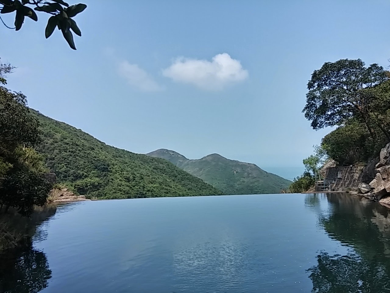
Man Cheung Po's infinity pool (萬丈布)

Duration: 
(4 kilometers)
1 hour

Difficulty: 3/10. 140m climb. Easy peasy...

Cel phone coverage: None.

Water needs: 0.5 liter

Appreciation: 9/10 for the infinity pool for a swim in the middle of summer

Transportation: Take bus 11 from Tung Chung to Tai O, and back. On weekends and holidays, there might be tons of people, then, you can take the ferry to Mui Wo, take bus 1 to Tai O and back.

Why it's worth it:

Garmin: http://connect.garmin.com/activity/481954409
---------------------------------------

If you go before 9am, head to Tung Chung, otherwise, ferry to Mui Wo and take bus #1 to Tai-O. You'll thank me for that...
Anyhow, for the early risers, when in Tung Chung, exit @ 'B'. Then go straight.

You should find bus stop 11 behind the bus terminus. About 45 minutes to Tai-O

Right behind the Tai-O bus terminus, there's a pier. Go there and just follow it around...

... to the little village and then to the right, along the shore for about 10 minutes

Follow the shore...

Follow the indications towards Man Cheung Po. Still following the shoreline at this point

Here, you still follow the Man Cheung Po sign, leaving the shoreline and climbing a bit

About 2.4 km into the hike (35 minutes), you'll reach this point...

... do NOT follow the Man Cheung Po signs at this point, just keep going on the path. Not the stairs, the path. You could take the stairs... but that would be wrong... So path it is, right?
(The concrete thing on the ground. Ok ok, just making sure, I'll just shut-up now)
(path...)

About another 8-10 minutes walk later, you'll reach a second set of stairs; those are good. Take them. They will lead you straight to the infinity pool.

Blue house. You're not lost

Pool in sight

There you are! Enjoy the waterfall and the infinity pool. Well, actually, it's a catch basin and you are technically not supposed to be or swim there... technically...

Pwetty...


Monday, April 16, 2012

MacLehose Section 9 & 10


Duration: 
(21.9 kilometers) Between 5.5 and 6.5 hours depending on walking speed.

Difficulty: 4/10. Quite easy, long as there is not way to get back between sections 9 and 10.

Appreciation: 3/10. Boring, mostly paved. If you want full bragging rights for MacLehose, you gotta do it. If you want to experience the best of Hong Kong trails, that is not one of them.


Transportation: Get to the Twen Wan West MTR station. Exit D. Walk to the Nina Tower bus terminal (about 5 minutes). Take KMB bus 51 (http://hketransport.gov.hk). Stop at 郊野公園 COUNTRY PARK

At the end of the trail, just follow my instructions to get to Tuen Mun MTR, about 500 meters from trail end.


Why it's worth it: 
It really isn't compared to the other sections but here's an idea


---------------------


Exit 'D' at Tsuen Wan West. 5 minutes walk to Nina Tower bus terminus (the tallest building you see coming out of the MTR station)

Take KMB 51 and stop at Country Park. Retrace your steps a little bit. The trail head as by the big 'Welcome to Yuen Long' sign.

Go past the gate, hang out right and follow the road that is going up a little bit. From there, follow the  milestones posts and the little hiker signs, you should not get lost. Remember, there's one milestone every 500 meters.

Click to enlarge.

Click to enlarge.


This is almost at the end. You may be tempted to use the shortcut on the left but that is not the end of MacLehose section 10. About 2 more clicks to go.

That's the trail end. The Tuen Mun MTR station is on the road  going straight in front of you (not the one  perpendicular to you)

You want to cross the road on the left side so you can then take the pedestrian walkway that parallels Pui To road. Once off the walkway, go underneath the highway to be on the right of Pui To Rd. About 300 meters along Pui To, you will find the entrance to Tuen Mun's MTR.


Hike Hong Kong Web Site

HikeHongKOng on Facebook

Please, don't litter!

Hiking is about communion with nature. So please pickup after yourself. There's no excuse to leave plastic bags, water bottles or any rubbish on or around the trails; if you managed to bring it, you can manage to bring it back!