Showing posts with label hong kong trail. Show all posts

Sunday, July 5, 2015

Hong Kong Trail Section 3 and 4

Duration: 
(15 kilometers)
4 hours

Difficulty: 4/10

Cel phone coverage: Everywhere

Water needs: 2 liters. Please, do not litter! 

Appreciation: 7.5/10. While there aren't many nice views, section 3 of the Hong Kong trail is shaded and goes through nice woods and streams, with the occasional waterfalls. Quite a nice trail on a hot summer day

Transportation: CityBus No. 7 from Exchange Square. Get off at Tsung Man Street in Aberdeen. Return via buses 6 (to Central) or 76 (Causeway Bay) at Wong Nai Chung Gap.

---------------------
Get off at Tsung Man Street in Aberdeen

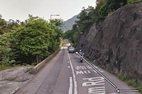
Keep on going on Aberdeen Reservoir Road

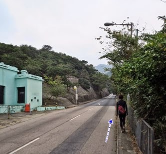
Until you reach Peel Rise. Take a left on Peel Rise 

Keep going up on Peel Rise, you'll get to this barrier. Keep going straight...

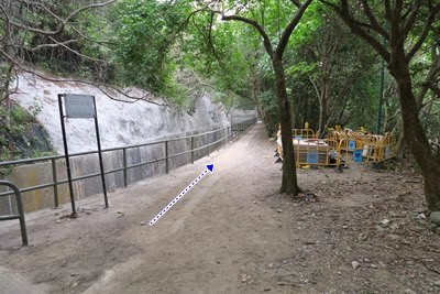
... you'll reach the trail head on your right, take it. There will be a map. Keep on the trail (don't take the stairs, they bypass pretty much all of section 3)

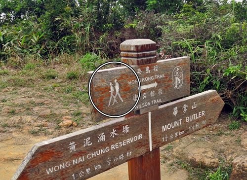
En general, just follow the signs with the little hiking guys...

Keep following the HK trail signs...

At the end of section 4. Buses will be on your left.

Sunday, April 19, 2015

Hong Kong Trail Section 1 & 2

Duration: 
(11.5 kilometers)
3.5 hours

Difficulty: 4/10

Cel phone coverage: Everywhere

Water needs: 1 liter

Appreciation: 8/10. Leisurely hike with good views of the harbour. Shaded.

Transportation: Bus 15 to the Peak from Exchange Square in Central. Return to Central via bus 43x in Aberdeen.

Why it's worth it:

Maps: http://hiking.gov.hk/eng/pdf/longtrail/hktrail/hkmap02.pdf

---------------------------------------
Once you're off bus #15 at the Peak terminus, walk towards the Peak building which houses the Peak tram terminus. Then, spot the white building on the left, pictured above (and highlighted with a square on the top-view map above).  You will be walking in front of it, to the right, on Lugard Road. Make sure you don't take the steps to Old Peak Road, nor walk to the left of the building (Mount Austin and Harlech Road)...
... There's actually signage for the Hong Kong Traild right udner the Lugard Road sign. SHouldn't be too difficult to find your way. From this point on, it is quite straight forward; stay on the main path, don't take the side-paths climbing the mountain on your left, unless there's signage for the Hong Kong Trail indicating you to do so
After having gone around the Victoria Peak, you'll arrive at the Peak, Harlech and Lugard Road intersection. There's a pavillion there (white circle on the map). Take the path parrallel to the Harlech Road sign (you're coming from the Lugard Road on the map). Keep going there. Quite easy afterwards...
About an hour walk later, you'll see stairs on your left. There's signage for the trail too. Keep following the trail. There's plenty of signage (always the 2 little hiking guys). You have about another hour or so to go before we exit the trail
You'll eventually go down steps and reach the catchwater. You'll be going to the left. Keep following the catchwater until you reach the set of stairs pictures above. Signage will say 'Tin Wan Estate'. That's not the official end of section 2 per se but there's not much of a point to keep going to the end. Take the stairs down to Aberdeen
Stairs are marked by the small square on the map. As you come down to Tin Wan Estates, go around the buildings on the right. Go down Tin Wan road as per the map above. The bus stop is in front of the Tin Wan Shopping Centre. Bus 43x will bring you back to Central

Monday, April 13, 2015

Hong Kong Trail Section 5 & 6

Duration: 
(7.5 kilometers)
3 hours

Difficulty: 6/10. 

Cel phone coverage: Everywhere

Water needs: 1 liter

Appreciation: 8/10. Great views of the harbour at Jardine's lookout

Transportation: CTB bus 6 from Exchange Square. Get off at "Wong Nai Chung Reservoir Park". Do not take 6x as it goes through the tunnel. Return on Tai Tam Rd via NWFB bus 14 to Sai Wan Ho MTR station, or green minibus 16 to Chai Wan MTR station.

Why it's worth it:


---------------------------------------


Wong Nai Chung Reservoir Park bus stop. It is right by the Shell gas station. Climb-up the stairs. You'll end up on Tai Tam Reservoir Road.

Head left on Tai Tam Reservoir Road. Keep walking on Tai Tam Road until you hit the trail head which will be on your left. About 10 minutes walk.

The trail head, across from the Parkview housing complex.

Right at the beginning of the trail, just make sure you take the stairs on the right.
Quite hard to get lost on the trail, just follow the signagne and stay on Hong Kong trail. The milestone signs are pre-fixed with an 'H'. The little hiking guys are also displayed. The Wilson and Hong Kong trail overlap for about 2km, just make sure not to take the Wilson trail at the crossroads a short time after the quarry, keep going straight on Hong Kong trail
You'll eventually get to the top of Mount Buttler. At this point, it's pretty much down all the way...
After about 3k (not sure why the official maps say 4k), you'll reach the end of section 5. Many roads cross here. Make sure to take the Tai Tam Tuk road (not a path at this point), on the right. The road gently slopes down
You'll eventually arrive at the dam, which you must cross. Then end to the left. Keep following the HK trail signage.

You'll arrive at a point where the road you're on keeps going straight but there are stairs on your left. Take the stairs. You are about 20 minutes away from the end of Section 6
You'll arrive at the end of Section 6. Can't miss it, there's Tam Tam Road and the big board with the trail map. The bus stop is on your right, about 100m away. Be super careful as there are no sidewalks. HK gov should really do something about that...

Sunday, February 1, 2015

Hong Kong Trail Section 7

Duration: 
(8 kilometers)
2 hours

Difficulty: 3/10. Flat all the way but for steps on the last 500m

Cel phone coverage: Everywhere

Water needs: 1 liter

Appreciation: 5/10. Pretty much walking by water catchment all along. Some occasional nice views. Beaches but not the most attractive ones. I don't think I will return to this one.

Transportation: Citibus 14 from Sai Wan Ho (Exit A). Return via bus #9 to Shau Kei Wan

Why it's worth it:

Garmin: http://connect.garmin.com/modern/activity/687307861
---------------------------------------
Take Bus 14 right off Exit 'A' at Sai Wan Ho MTR station. Get off at Tai Tam Reservoir (North) stop.
Then retrace your steps for about 100 meters. Be careful, there's no sidewalks for the last 25 meters.

Take the path going down on the right. You will see the trail map on the other side of the road

Then quite trivial; just follow the water catchment pretty much all the way...


6.5km in, you'll see this intersection, if you go to the right, you'll arrive at a little beach. Nothing much to see there but if you feel like it... HK Trail Section 7 continues on the left...

At To Tei Wan. Not the best of beaches (quite a lot of pebbles)

Once done beaching, just continue up the stairs to the road. Only 500m to go but all stairs

You'll get to the road. Bus #9 on your side of the road will get you back to the MTR

Sunday, January 27, 2013

Hong Kong Trail Section 4


Appreciation: 7/10. An easy hike that is short and shaded. Perfect for a slow afternoon. A forest hike so no much in terms of views. Some WWII remnants and quite a few cats towards the end.

Why it's worth it: 


Duration: 
6.5k
285m elevation gain
Total: 2 hours

Garmin GPS route: http://connect.garmin.com/activity/266067566

Difficulty: 
5/10.

Cel phone coverage: Coverage everywhere.

Water needs: 0.5 liter.

Transportation: Take NWFB #15 from Exchange Square and get off at Wan Chai gap road. Return to Causeway Bay via CityBus #76 (will stop close to TimeSquare where you can take the Causeway Bay MTR).

--------------------
Off the bus at Wan Chai gap. Walk towards the little park and gazebo. Take the road immediately to the left of the park (Mount Cameron Road)

100m into Mount Cameron Road, you will see the intersection to  Aberdeen Reservoir Road and the trail sign. Head right onto Aberdeen Reservoir Road
Another 250 or so meters in, you'l reach the fork to Lady Clementi's Ride. While it is not the "official" entry point to HK trail Sec 4, it's a little shortcut that will bring you to a WWII  bunker. How's that? Let's go and take it.


The WWII bunker in question.

Keep going on Lady Clementi's Ride for a few more minutes and you'll reach Hong Kong Trail Section 4. Head left.

You are on the right path...
Just keep following the little hiker guys on the sign, towards Black Link's
About 1 hour into the hike
Some of the rare views


At Black Link's road, hit right.

Be on the lookout for the mighty little felines on either sides of the road.

There you go; end of Section 4, start of Section 5. The bus stop is just around the corner (where the car is going on the picture)


Hike Hong Kong Web Site

HikeHongKOng on Facebook

Please, don't litter!

Hiking is about communion with nature. So please pickup after yourself. There's no excuse to leave plastic bags, water bottles or any rubbish on or around the trails; if you managed to bring it, you can manage to bring it back!