Showing posts with label heritage. Show all posts

Sunday, July 4, 2021

Quarry Bay (鰂魚涌) to Repulse Bay (淺水灣) via Tai Tam reservoirs (大潭水塘)

Duration:

(10 kilometers)
3 hours

Difficulty: 5/10. 424m elevation gain. Rating 5 instead of 2 because the last 200m is steeper and can be slippery. About 70% shaded.

Cel phone coverage: Everywhere.

Water needs: 1.5 liter

Appreciation: 8/10. Nice after a downpour, creating lots of small waterfalls. Historical site of Tai Tam.

Transportation: Quarry Bay MTR exit A. Return via numerous and frequent buses in Repulse Bay, on Repulse Bay Road.

Why it's worth it:


Map & Details: 


Exercise Area: Yes (Quite a few along Mount Parker Green Trail)

---------------------------------------
From Quarry Bay MTR exit A, turn right on King's road. 
Then walk for about 250m to Mount Parker road (on your right). 
You can't miss it, there's a big brown sign announcing the Mount Parker Green Trail.
Walk up on Mount Parker road, which will merge into the Green Trail.

This cooked food centre on Mount Parker Road is quite good.


After about an hour (3.5km) on the Mount Parker Green Trail, you will reach the Quarry Pass Pavillion. Take a right towards Tai Tam Tuk reservoir. Still is Mount Parker Green Trail.


Keep going towards the reservoirs.

At the upper Tai Tam dam (1h25. 5.3km), you will be leave Mount Parker Road by crossing the dam, and then heading left right after on Tai Tam reservoir road.


Around 1h45m (6.8km) and immediately after crossing the masonry bridge on Tai Tam reservoir road, take a right, towards the Tai Tam Intermediate Reservoir.

Keep on left here...

At the Tai Tam Intermediate Reservoir Dam, you can take 5 minutes to walk to the middle of the dam to take a few pictures. When done, come back and take the dirt path that follows along the South side of the reservoir.


About an hour walk from the Intermediate Reservoir Dam, you will be reaching this point; Tze Kong Bridge (Repulse Bay Gap). Cross the bridge, take an immediate left, then immediate right and down the path with a sign that advise you not to do so... ;-) 
At this point, you are about 200m away from Repulse Bay

Soon enough, you will reach this road (South Bay Close), with the Hong Kong International Primary School on your left. Take the concrete steps down and just follow the road down.


You are almost there, follow the road to the left, then take the next right...

... and there you go: The Pulse, for late lunch or early dinner. Maybe some beach time afterwards. Once you are done, walk along Beach Road and you will see stairs on your right that will take you to Repulse Bay Road where there are tons of buses that will take you back to the city.


Tuesday, July 7, 2020

3 Fathoms Cove (Kei Ling Ha Hoi - 企嶺下海) with Lai Chi Chong (荔枝莊) detour

Duration: 
15km (5 hours)

Difficulty: 
7/10. Elevation gain of 450m

Cel phone coverage: Almost none.

Water needs: 2 liters. 50% shaded

Appreciation: 8/10. Nice forested path will have you go through the villages of Pak Sha O, Nam Shan Tung, Lai Chi Chong, and Sham Chung.


Exercise Area: No

Transportation: Get to Sai Kung Pier (Many ways to get there. Check-out https://www.hkemobility.gov.hk/index.php?golang=EN) .Then take minibus 7 and stop at Pak Sha O Youth Hostel. You can show the bus driver the following if you want to make sure not to miss your stop (that's the second last stop).
Return to Sai Kung via bus 99, or 299.


Why it's worth it: 

Sunday, June 30, 2019

Tung Lung Chau (東龍洲) loop

Duration: 
7km (4 hours)

8/10 if not too hot. Some bushwacking, steep & slippery down. No shades. 10/10 on a hot day

Cel phone coverage: Full.

Water needs: 2 liters.

Appreciation: 8/10. 


Exercise Area: No

Transportation: Yau Tong MTR exit 'A'. walk to Sam Ka Tsuen Public Pier, then ferry to Tung Lung island. Back the same way.
Ferry schedule: 
https://www.td.gov.hk/en/transport_in_hong_kong/public_transport/ferries/kaito_services_map/service_details/index_t.html#k02


Why it's worth it: 
Some nice views but there's also a few other things to see and do on the island, such as the 19th century rock carvings, the Tung Lung Fort, and a few places to get a decent meal.
https://en.wikipedia.org/wiki/Tung_Lung_Chau


----------------------------------------
Yau Tong, Exit A2

Go down the stairs on the right, right out of exit A2. Then just keep following Cho Kwo Ling Rd road, all the way


Will take you about 10 minutes to get here from the MTR
Right after the last bend, the road straighten-up and the ferry pier as at the end 


You will have to get a return ticket. They will ask you for return time; you can pick the last return as you always have the option to take an earlier ferry back.

After a scenic 30 minutes ferry ride, you will arrive at Tung Lung island. It is the terminus, you can't get it wrong.


At the first cross-road, hang-out left.

Then right at the Chinese restaurant. (You will be looping back here)


Paved path for most of the trail, and there's one path so, quite easy to navigate


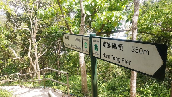
At this point, you will get to a fork. I suggest you first go explore the ancient rock carving on the right.
Once done, you will come back to this fork and keep progressing on the path on the left (2)

There's an explanatory sign on the middle of a promontory. The stairs down to the carvings are on the left.


The 19th century rock-carving
https://www.amo.gov.hk/en/monuments_03.php
Once done, retrace your steps to the fork and keep going

Luk Keng wan in sight.

You will get to this fork. If you feel like going to Luk Keng Wan, head right.
When done, come back here and keep going. You will be climbing to the summit; very painful on a hot day, easy otherwise.

Summit in sight

About 25m before arriving at the building, you will see a path on the left which you must take.
This is the way down from the summit. It is steep and slippery. If you are worried, trace your steps all the way back instead.

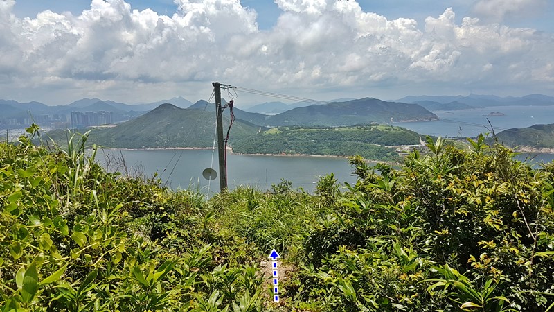
So, you have chosen to continue down the slope. There's a bit of bushwhacking but the path is quite clear and mostly follows underneath the electrical posts. 


The steep portion.

You made it all the way down!


You will reach this path, head right towards a small village where you can get a bit of food and drinks.
From there, you can follow the signs to visit Tung Long Fort (about 300m).
https://en.wikipedia.org/wiki/Tung_Lung_Fort
Once you are done, retrace your steps back to this village...

... and you can go back to the Public Pier by following the sign to 'Rock Carving' about 500m away.

Hike Hong Kong Web Site

HikeHongKOng on Facebook

Please, don't litter!

Hiking is about communion with nature. So please pickup after yourself. There's no excuse to leave plastic bags, water bottles or any rubbish on or around the trails; if you managed to bring it, you can manage to bring it back!