Duration:
Between 3 and 4 hours depending on walking speed (took me 3 1/4)
Difficulty: 3/10. Pretty much flat and paved all the way. Not a 1 because it's 15k long.
Appreciation: 8/10. Nice walk with a some history and good food.
Transportation: Tung Chung MTR to get there. In Tai O, you can take the ferry back to Central or return bus to various locations (including back to Tung Chung)
Garmin GPS route: http://connect.garmin.com/activity/212666681
Why it's worth it:
(300 years old Camphor Trees in Sha Lo Wan, Tai O's "uncles" dishing out the snacks, ocean and mountain views, 300 years old Yeung Hau temple in Po Chue Tam.
-------------
 |
| Tung Chung MTR Exit A. |
 |
| Cross all the cab stops towards the apartment towers in front of Exit A. |
 |
Refer to Point 1 on the map. You will be on a path that parallels Tai Tung Road until it reaches Shun Tung Road.
Do not turn right into the tunnel, instead, turn left. |
 |
| After about 100 meters, there will be a tunnel on your right. Take it. |
 |
Bunch of steps right in front of you. Don't take them, follow the path on the left.
|
 |
| Click to enlarge. |
 |
| After the tunnel, walk about 200 meters and take the catwalk over Chung Yan Road. |
 |
| Keep walking for another 200 meters or so, you'll go past housing estates on your right and get to another catwalk. Don't take that one, just keep going straight. |
 |
| Just before the end of Tu Yung Road, you will turn right at a sign post indicating the way to Hau Wong temple. |
 |
| Down the stairs, turn left. |
 |
| In general, just follow the signs indicating Tai O. |
 |
| About 1 kilometer in, in a small village. |
 |
| Just added this one because it may be confusing. But again, just follow the signs that indicate Tai O. From this point on, in it smooth walking without real possibilities of a wrong turn until Sham Wat Wan, 9 kilometers along the way. |
 |
| Sham Wat Wan. The ladies there at the village will surely remind you that there's food to be had if you are hungry. If you don't plan to stop, keep walking on the road through the village and over the bridge. |
 |
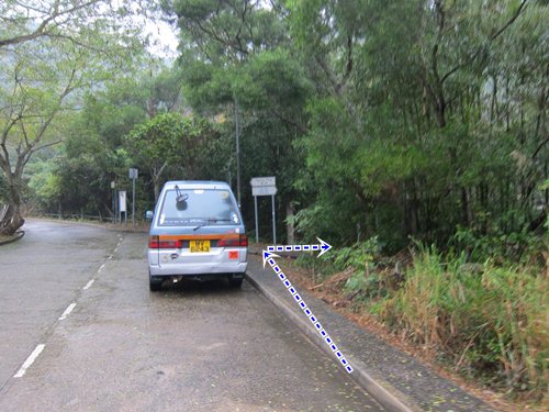
| About 100 meters after the bridge, there will be a path on your right with signage indicating Tai O, take this path on your right. From that point on, it's very easy to follow the Tai O signage all the way to Tai O. In Tai O, you can't really get lost. The buses are after the 2 bridges in the town. |