Showing posts with label section 2. Show all posts

Sunday, April 19, 2015

Hong Kong Trail Section 1 & 2

Duration: 
(11.5 kilometers)
3.5 hours

Difficulty: 4/10

Cel phone coverage: Everywhere

Water needs: 1 liter

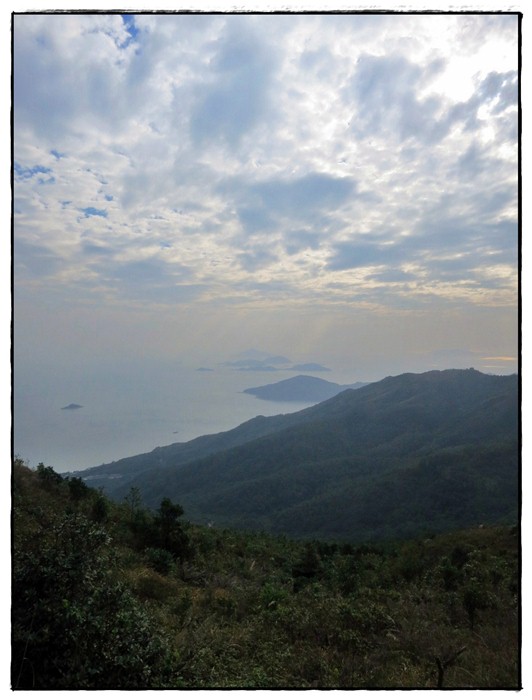
Appreciation: 8/10. Leisurely hike with good views of the harbour. Shaded.

Transportation: Bus 15 to the Peak from Exchange Square in Central. Return to Central via bus 43x in Aberdeen.

Why it's worth it:

Maps: http://hiking.gov.hk/eng/pdf/longtrail/hktrail/hkmap02.pdf

---------------------------------------
Once you're off bus #15 at the Peak terminus, walk towards the Peak building which houses the Peak tram terminus. Then, spot the white building on the left, pictured above (and highlighted with a square on the top-view map above).  You will be walking in front of it, to the right, on Lugard Road. Make sure you don't take the steps to Old Peak Road, nor walk to the left of the building (Mount Austin and Harlech Road)...
... There's actually signage for the Hong Kong Traild right udner the Lugard Road sign. SHouldn't be too difficult to find your way. From this point on, it is quite straight forward; stay on the main path, don't take the side-paths climbing the mountain on your left, unless there's signage for the Hong Kong Trail indicating you to do so
After having gone around the Victoria Peak, you'll arrive at the Peak, Harlech and Lugard Road intersection. There's a pavillion there (white circle on the map). Take the path parrallel to the Harlech Road sign (you're coming from the Lugard Road on the map). Keep going there. Quite easy afterwards...
About an hour walk later, you'll see stairs on your left. There's signage for the trail too. Keep following the trail. There's plenty of signage (always the 2 little hiking guys). You have about another hour or so to go before we exit the trail
You'll eventually go down steps and reach the catchwater. You'll be going to the left. Keep following the catchwater until you reach the set of stairs pictures above. Signage will say 'Tin Wan Estate'. That's not the official end of section 2 per se but there's not much of a point to keep going to the end. Take the stairs down to Aberdeen
Stairs are marked by the small square on the map. As you come down to Tin Wan Estates, go around the buildings on the right. Go down Tin Wan road as per the map above. The bus stop is in front of the Tin Wan Shopping Centre. Bus 43x will bring you back to Central

Sunday, December 30, 2012

Lantau Trail Section 1 & 2

Appreciation: 8/10 overall. Section 1 is pure waste of time but about 1 hour in (4km) and into Section 2, great vistas are well worth the climb.

Why it's worth it: 


Duration: 
8.15k
827m elevation gain
Total: 3 hours

Garmin GPS route: https://connect.garmin.com/modern/activity/255733934

Difficulty: 
7/10.

Cel phone coverage: Coverage everywhere.

Water needs: 1 liter.

Transportation: Ferry to Mui Wo from Central pier. Return via 11, 23, 3M right at the end of section 2 to either Tung Chung where you can take the MTR, or Mui Wo where you can ferry back. 

--------------------
Head right upon disambarking the Mui Wo ferry.

Start climbing along the road by the roundabout.

You will see this sign. Follow it for until you reach the Section 2 trail head.

Section 2 trail head. There's a drink vending machine and toilet in case you forgot.

The rest is trivial. No real need for further details as all the intersections have clear indications. Just follow Pak Kung Au via Sunset Peak

Sunday, March 11, 2012

Wilson Trail Section 2


Duration: 
(6.5 kilometers) Between 2 and 3 hours depending on walking speed.

Difficulty: 5/10. 

Appreciation: 8/10.  

Transportation:  Take City Bus #6 (Can be taken at Exchange Square) and get off at Wong Nai Chung Reservoir Park bus stop. Swipe your Octopus on exit to get the discount.
The trail ends at Tai Koo MTR station.

Why it's worth it: Nice mountains and city views. Nice trail. You should absolutely go on a clear day, otherwise you'll have no views and the trail will be a lot more boring.


------------------

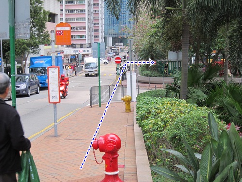
Wong Nai Chung Reservoir Park bus stop. It is right by the Shell gas station. Climb-up the stairs. You'll end up on Tai Tam Reservoir Road.

Head left on Tai Tam Reservoir Road. Keep walking on Tai Tam Road until you hit the trail head which will be on your left. About 10 minutes walk.

The trail head, across from the Parview housing complex.

Trail map. Click to enlarge. However, if you just make sure you follow the little hiking icon at every turn, it is quite hard to get lost. And there are the 'W' milestones every 500 meters.

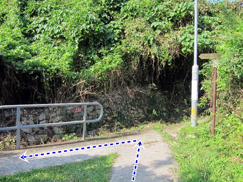
Right at the beginning of the trail, just make sure you take the stairs on the right.

A little bit less than halfway in, follow the Wilson trail sign (turn left).
Otherwise, you'll be doing the Hong Kong trail portion.


The Wilson trail and the Tree Walk merge for the full lenght of the Tree Walk.

At the first set of antique outdoor "BBQ' pits, go straight.

At the second set, then you will have to walk by the BBQ pits and go  down at the end.
The signage is a little bit easier to miss.

The only part where signage is really bad. At this point, head left. Going right will lead you the wrong direction.


No intersection but just so you know you are still doing fine.

At Greig Road, turn left.

Go straight, through the lights, where Greig Road continues (Yau Man is the street on the left).  

Almost there. Take a right on King's road.

Keep walking on King's road until you reach Tai Koo MTR station.
There will be an entrance on your right.

Monday, November 28, 2011

MacLehose Section 1 & 2

(Updated 2020-DEC-19)
Duration: 
(24.1 kilometers)
Section 1: Between 2 and 3 hours depending on walking speed (took us 2)
Section 2: Between 3.5 and 5 hours, depending on walking speed (took us 3.5)

Difficulty: 
7/10. Section one is a road, 90% flat. Really easy. Section 2 has some more challenging hills. About 300 meters ascent. 30% shaded.

Cel phone coverage: No.

Water needs: 2 liters.

Appreciation: 10/10. The views are incredible, especially in Section 2. Long Ke beach really, really nice.

Map & Details: 
https://www.hiking.gov.hk/trail/info/id/VFFUbFFNOXNXTHNWU2FqT09UTjlOZz09/map_type/1#route_map
https://www.hiking.gov.hk/trail/info/id/d0pFSWc1N1dWdkh3aStSajBvUHlmUT09/map_type/1#route_map

Exercise Area: No

Transportation: From Diamond Hill MTR station, KMB 96R will take you directly to Tai Mong Tsai Road where you get off at Pak Tam Chung stop (Sundays and Public holidays only). Otherwise, you can take bus 92 to Sai Kung, then 94 to Pak Tam Chung stop. Return is even easier as section 2 ends almost right in front of a 94/96R bus stop.

Why it's worth it: 


-------------

96R at Diamong Hill MTR station. Very busy on Sunday mornings!


Pak Tam Chung stop bus stop.

Walk about 100 meters and head right. That's MacLeohose's trail head.
Click for larger version. All the spots marked with a number are referenced in the photos that follow.

Just follow the road. With nice vistas on your right...

... and on your left.

Not very complicated but just in case...

Head left.

Ain't that beautiful?

Right after the principal dam and the pavilion, you'll head left and start climbing.
At this point, you have cleared MacLehose Section 1. Go checkout the dam however, worth a few extra steps.

After 20 minutes or so of climbing up and down, you'll reach Long Ke beach which is  paradisaical and  nicely shaded, making it a nice spot for pic-nics or even camping if you're into it. Once you're done, follow the trail, more climbing and awesome vistas as per photo (Long Ke)


After the 300 meters climb, you'll start going downhill and eventually reach the merging point with the trail that most Sunday hikers take coming from Sai Kung (it is much easier). Head right.

Arriving in Sai Wan village.

Food break or keep going.

Sai Wan beach. The next bit has no shades so it is a bit painful if you do it in the summer and mid-day. 

After 30-40 minutes and a few "wow" moments, you will have reached Ham Tin Wan where you can rest a bit, have some food, restock your water supply and enjoy the beach.
Once you are done, go right through the store and take a left.


After this point, it's all quite obvious; just follow the trail. It is not a steep climb but it keeps going up for about 50 minutes with not much in terms of nice views as rewards for a job well done. 

At this point, don't go straight, keep on the path. You are about 25 minutes away from Tai Mong Tsai road and the end of Section 2. Once at the road, the bus stop will be on your side of the road and to the left.
Congrats on completion of MacLehose Section 1 & 2. Please note that section 3 starts just across the road, should you be tempted to go on.


Hike Hong Kong Web Site

HikeHongKOng on Facebook

Please, don't litter!

Hiking is about communion with nature. So please pickup after yourself. There's no excuse to leave plastic bags, water bottles or any rubbish on or around the trails; if you managed to bring it, you can manage to bring it back!