Showing posts with label very hard. Show all posts

Monday, August 27, 2018

Dai Shek Stream (大石石澗)

Duration: 
10km total. About 1km in the stream

Difficulty: 
10/10. Would strongly advise not to do that stream unless you have a lot of experience stream-trekking, are comfortable with rock-climbing, and will be extremely watchful of loose rocks. There has been a few fatalities on that trek. It is the most dangerous one I have taken part of, due to the loose rocks which can not only cause one to fall, but also, is dangerous for people following. Out of our party of 8, 5 fell or slid during that trek. With one falling about 3 meters.

Cel phone coverage: Sparse.

Water needs: 2 liter.

Appreciation: 9/10. Lots of waterfalls. 


Exercise Area: No.

Transportation: Tsuen Wan West MTR, Exit A1. Bus 51, Shek Kong Village stop. Return via bus 51 at Route Twisk.

Why it's worth it: 

----------------------
Tsuen Wan West MTR. Go out at exit A1 and up to the bus terminus. Take bus 51. 


After about 20-25 minutes bus ride, alight at the 'Shek Kong Village' stop. Then retrace your steps a bit...
… and cross the road as the "path" is on the left side.


After 5-7 minutes walk, you'll see a bunch of small concrete pillars on the left, at a turn in the road, as well as a rain catch.
This is where you enter. Walk on the concrete catch.

There's a sign stating the obvious. At this point, if you feel uncomfortable continuing, DON'T !
There is no shame in aborting. Don't be peer pressured.

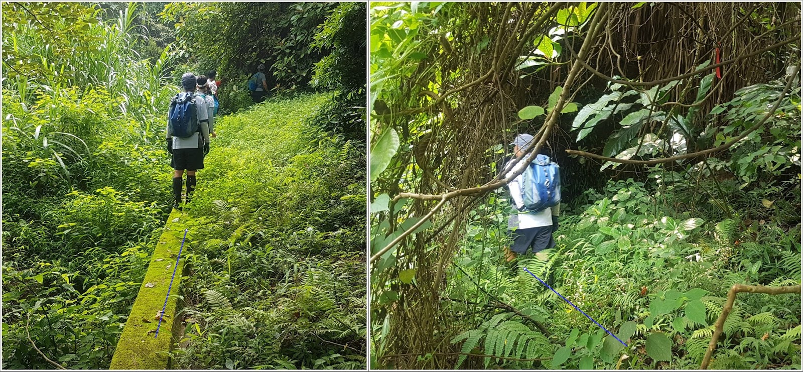
Keep on the catch-water concrete structure. It will stop, keep straight. You will see a red ribbon, go slightly left.
You should hear the stream.

Refer to the big slanted tree. In any case, the stream is right ahead of you. 
Careful, slippery

Ribbons. Not always very visible because the colors are worn-off

Another catch-water structure on the way down to the stream. 
You are about 30m away from the stream, which you should hear clearly by now.

You should be entering the stream about here. 
No real chance to get lost. Just go up the stream and stay right at any of the forks
Bypasses are generally quite obvious but beware of loose rocks. Always keep 3 points of contact, and test your anchor points; make sure it is firmly secured to the ground and not brittle. Most of the tall waterfalls are bypassed on the right.
Climb on the right of this one. Most of the holds are actually roots
Climbing on the right. This gives you have good idea of the difficulty level.
Still bypassing on the right.
After a few more easier waterfalls, the stream dies out and you basically will be just walking on rocks. Just keep going straight up and you will get out of the woods and close to the top of a hill.
Climb the hill just enough so you can see behind to your right...
… you should see poles/pylons. The trail is there. On a weekend, there should be quite a few hikers there. You may have to bushwhack your way there but it is at most 150m.
You are mostly home-safe! Go right on the path, towards the weather-radar station's dome. Then, follow the path all the way down to Road Twisk (about 5km) where you will see the bus 51 stop which will bring you back to Tsuen Wan/Tsuan Wan West MTRs

Sunday, January 22, 2017

Bride's pool, Wu Kau Tang (烏蛟騰) to Bluff Head/Wong Chuk Kok Tsui (黃竹角咀). Devil's Fist (鬼手岩)

Duration: 
One way: 6hours, 14km. From Wong Chuk Kok Tsui to Wu Kau Tang. You have to get a speedboat to drop you off at Wong Chuk Kok Tsui
Return:  9-12 hours, 28km. You will have to either leave very, very early (6am) so you can make the return minibus, or plan to camp there

Difficulty:
One way: 8/10. Hard because of distance, terrain (slippery, loose rocks), bushwacking, 500m elevation gain
Return: 10/10. Double the distance and elevation gain! Only for experienced hikers. In both cases, I would suggest shades, long sleeves and long pants because of the bushwacking part. Don't skimp on water

Cel phone coverage: No coverage

Water needs: 2.5 liters

Appreciation: 9/10. Nice views. Interesting rocks formations. But don't get your hopes up too much for Devil's Fist; it is a small rock formation.

Transportation:
One way: Hire a speedboat to Wong Chuk Kok Tsui (黃竹角咀). Devil's Fist (鬼手岩), then hike to Wu Kau Tang. There, minibus 20R will take you to Tai Po Market MTR station. Last 20R is at 8:15pm so manage your time wisely!
Return: Minibus 20R from Tai Po Market to terminus Wu Kau Tang. Return the same way. Again, last 20R is at 8:15pm !


Why it's worth it:
----------------------------
Below are the instructions for the return trip to Wong Chuk Kok Tsui. Again, only for the experienced hikers (ones who routinely can do 15k+ hikes in non-flat terrain)
Exit A at Tai Po Market MTR station. Go in the tunnel. The go towards the Minibus terminus (left)

Minibus' schedule calls for once every hour, but they often add buses due to the route being quite busy on weekends. The bus trip to Wu Kau Tang is between 30 and 45 minutes. Wu Kau Tang is the terminus (pictured here)

A few meters back on the road where the bus came from, there's a path leading to the village. Take it

Go through the small village

Left or right around the toilet. Doesn't really matter. Path afterwards will be on the right

Just out of the small village

You want to go towards Plover Cove Country Trail


Can't miss it; a big board with a map of the trail. Take the path going up on the left of the board


Nice views along the way...


An hour and a half or so along the way. Head right at the sign. On your way back, you can always take the other way to Wu Kau Tang which is a bit easier (less scenic) and faster

Yeah, yeah...

At this point, take the path to the right...

Just as a reference


This is where you leave the Plover Cove Country trail and get on the bushwacking path towards Wong Chuk Kok Tsui. About 3.5hours/7km from the bus-terminus in Wu Kau Tang

The trail is mostly well-worned. When it gets a little bit more questionable, follow the ribbon markers

At this point, you probably have another2, 2.5 hours to go. When you reach a big pile of rocks with a sign (all in Chinese), you're almost there. The path keeps going to the right, then down to the water. The Devil's fist is there right on the rocky beach. The path going down is a bit treacherous so big mindful of loose rocks and slippery terrain. Once you are done marveling at Nature, retrace your steps all the way to Wu Kau Tang

Sunday, July 7, 2013

Shui Lo Cho (水澇漕), Man Cheung Po (萬丈布), and Lung Tsai Ng Yuen (龍仔悟園)

Duration: 
(9 kilometers)
4 to 5 hours

Difficulty: 10/10. Hands required to climb some of the sections, even the bypasses. Option to make it easier is to stop at the infinity pool and return.

Cel phone coverage: None in the stream. Some when within 1 km of Tai-O

Water needs: 1.5 liters

Appreciation: 9/10. You can swim in all the pools but for the reservoir one (infinity pool)

Transportation: Take bus 11 from Tung Chung to Tai O, and back.Tends to get busy on weekends and holidays. You can also ferry to Mui Wo, take bus #1 to Tai-O, return via 11 to Tung Chung.

Why it's worth it:

---------------------------------------

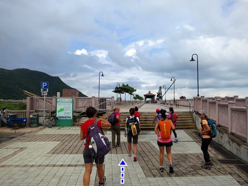
Just off the bus terminus, take the bridge
Pretty trivial at this point. Head right at the end of the bridge.

It's about a 3km mostly flat walk until you will reach the stream entrance.

The stream entrance, just after this little bridge

View on the right from the stream entrance

First falls is just about 50m in. Bypass is on the right.
However, you can also swim to the bottom of the falls and climb it directly. Quite easy
These falls can be bypassed on the left. From that point on, you can follow the yellow ribbons for the bypasses. Most of the time, you can also relatively easily climb in the waterfall itself. Then you'll reach the escarpment with the catch water basin (the so-called infinity pool). It should be bypassed on the left 'cause it is guarded now.


Right after that bypass, and about 1km into the stream, you'll reach the Man Cheung Po infinity pool (a catchwater bassin really). Nice to chill there for a while but can no longer swim. You can exit to the trail here or keep going up the stream. 
Then, right behind the infinity pool is a very tall waterfall which can be bypassed on the right.
That bypass is non-trivial. It is marked with yellow ribbons
Next waterfall is easy to recognized as it has a double stream. Bypass on the right
Right after, you reach a critical point in the trek where you don't want to go wrong. The streams forks into 2 branches. You absolutely want to be on the left branch. The right branch is more obvious but there's really nothing there all that interesting anymore and the exit is not obvious and involves bushwhacking.
So, stick to the left. There should be a ribbon marking the entry to the path to the left. Then you immediately climb the rocks that are in between the 2 streams.

Rocks to climb between the 2 streams. Very easy. No ribbons before you reach the top.

You will see these nice falls on your left (if they are not all dried up), you know you are on the right path.

Then the path on top of the ridge should be visible


Finally, you'll reach out the paved path right by a bridge that crosses the stream which was on your left.
Head left over the bridge

Right. 'TAI O via LUNG TSAI'

Left here at the intersection. From this point on, you can follow the yellow signs with 'TAI O via LUNG TSAI'


Lung Tsai Ng Yuen (龍仔悟園). The estate has been sold so, can't get in anymore.
For pictures and a bit of history: https://peterlamphotography.com/2015/01/25/ng-yuen-the-secret-garden/


There you go. From that point on, it is just a matter of following the path back to Tai-O where you can return home either via Bus 11 to Tung Chung, or bus 1 to Mui Wo, then ferry back to the city

Hike Hong Kong Web Site

HikeHongKOng on Facebook

Please, don't litter!

Hiking is about communion with nature. So please pickup after yourself. There's no excuse to leave plastic bags, water bottles or any rubbish on or around the trails; if you managed to bring it, you can manage to bring it back!