Showing posts with label ma on shan. Show all posts

Sunday, October 29, 2017

Tai Kam Chung (大金鐘)/Pyramid Hill, West to East

Duration: 
12.6km, 4 hours

Difficulty:
7.5/10. 622m ascent


Cel phone coverage: 100%

Water needs: 1.5 liter

Appreciation:
8/10. 

Transportation:
Tai Shui Hang MTR station, Exit B.
Return via Bus 299x, 99 to Shatin (going left when exiting the trail), or to Sai Kung (going right)


Why it's worth it:
---------------------------------
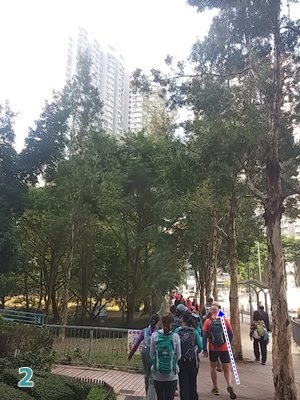
At Tai Shui Hang MTR station, take exit B (head left at the end of the corridor, and up the stairs)

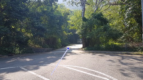
You'll be walking on that path for about 15 minutes until you reach this path on the right. Take it

At the gate, go right


Keep going past the BBQ site

Head left and follow the MA On Shan Country trail for a while

Right on Ma On Shan Tsuen (don't expect the green cab to be there...)

You'll reach this little village which has a coffee shop, shall the mood strike

Once replenished, take stairs

Then right at the top of the stairs, back on Ma On Shan Country Trail

After another 20 minutes walk, you'll reach this crossroad (there's a pavilion on the right).
If you head left, you will bypass Pyramid Hill so, head right!

After a few more minutes, you'll reach an open plain where you'll have a great view of Sai Kung. behind you is Pyramid Hill (pictured). When you are ready, climb it! Hands required at some points...

After you have come down Pyramid Hill, there's a path to the left.
That's the bypass path of earlier. Instead, follow the MacLehose sign and go straight


You'll see this guy from time to time...

Just before the next big climb, (about 3 hours and 7.7km into your hike), you will veer right, following the MacLehose sign. That hill will be for another day!

Right

Left. Just follow MacLehose basically


Last junction. You are almost there. Head right. You'll soon reach Sai Sha Road. The closest bug stop is about 3 minutes walk to your left. You can choose to go to Sai Kung, or Shatin


Sunday, January 11, 2015

The Hunch Backs - Ngau Ngak Shan (牛押山)

Duration: 
(17 kilometers)
7 hours

Difficulty: 9/10. First 2km are really steep, will often require your hands. Paths down are often slippery. Not good if you are afraid of heights. Long hike

Cel phone coverage: Most of the trail.

Water needs: 2 liters

Appreciation: 10/10. Amazing view. Walking on the peak of the razor-sharp mountains is exhilarating 

Transportation: Easy access. Wu Kai Sha MTR, then return via Wong Tai Sin MTR

Why it's worth it:


Garmin: http://connect.garmin.com/modern/activity/670511749
---------------------------------------
Make your way to the Wu Kai Sha MTR. Exit towards the LakeSilver escalators. Head left through the bus terminus. You should end up on Sha On Street...

Cross the street and head right.

Walk along the road to your right and green-space on your left...

Until you reach this point where there's a path on the left going through the green-space. Take the path.

Follow the path all the way through the green-space and underneath the highway overpass. Right after the overpass, hear left on the path.

You'll be walking a few meters on that path until you see a water drainage trench on your right. This is where the "trail" proper starts. Go up on the right of the trench.

Maybe 10-15 meters in, you'll see an actual beaten path on the right. This is where the fun begins. Take that path and start scrambling up.

You'll eventually reach this crossroad, take the path on the right.

Another crossroad. Go straight
You will essentially be climbing the dorsal fin of the mountain

At times, there'd isn't much between you and a steep drop. But the views are amazing

View of the first peak, Ngau Ngak Shan, from the second one, Ma On Shan.Keep following the trail until you reach section 4 of Maclehose. Then go South on Maclehose 4 and keep following it.

Here, straight ahead. Still on Mac 4. About halfway through I would say.


Road towards Shatin pass. At Shatin pass, you can replenish but you only have about 40 more minutes to Wong Tai Sin. Just keep going down the road.

Wednesday, October 1, 2014

Ma Dai Stream (馬大石澗)

(Updated: 2022-04-17)

Duration: 
(5 kilometers)
2 hours

Difficulty: 6/10.


Cel phone coverage: Everywhere

Water needs: 1 liter

Appreciation: 9/10

Transportation: Tai Shui Hang MTR exit B. Return via Hang On MTR

Why it's worth it:


---------------------------------------
At Tai Shui Hang MTR, take exit B. And then head left (North) following Hang Tak street.

Until you reach this point, about 100-150m in. Take the road on the right.


At the end of the road, just climb the fence on your left and take the steps.


Cross the bridge, then head left...
... the stream entrance is right there.


Hero's cliff. Magnificent waterfall. Nice place for a picnic and a swim.

Keep going. No significant waterfalls afterwards but at one point, you'll hit a fork, head left and there will be a bridge-like thing. Head left. Now, you will know you went on the wrong side of the fork ("Use the fork Luke!") if you arrive at the dam on the right on the picture. Just retrace your steps to the fork and head left and out of the stream. The stream portion is over, you are about 50 minutes away from the MTR.

At this point, the trail should be somewhat visible, just make sure you don't go there at night the first time...

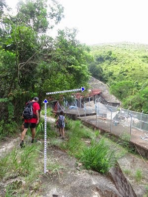
You'll eventually get to this farm. Go through on the left. Be respectful of private property.

As you get out of the village/farm, you'll hit Man On Shan Country Trail, head left.

You'll get to the pic-nic area where there are toilets if you need a pit-stop. 

Otherwise, keep going on the Man On Shan Tsuen road.


At one point, you'll see a hole in the fence on your left, next to a concrete structure, that's a shortcut, go through and go down the steep path.

Left at the trail.

About a hundred meters  onto the trail, there's a shortcut path on the right. Take it.

You'll get to the road. Head left.

You'll be able to go under the road-bridge

Then connecting to another road and sidewalk. Head right.

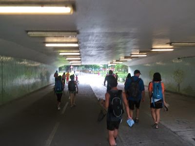
Then take the subway under the road. Should be relatively straightforward to the MTR (there are signs)

Through the garden. Admire the Chinese "bas-relief"


You'll end-up at Hang On MTR station. Quite a nice stream, isn't it?


Hike Hong Kong Web Site

HikeHongKOng on Facebook

Please, don't litter!

Hiking is about communion with nature. So please pickup after yourself. There's no excuse to leave plastic bags, water bottles or any rubbish on or around the trails; if you managed to bring it, you can manage to bring it back!