Monday, August 19, 2024

That's all folks!

 Dear all,

      as I can no longer update this blog, I wanted to let you know that it is officially dormant.

I will leave the content there for anyone who could still find it helpful.

The custom domain was shut down a few months back so, traffic went down to near zero.
I detach the custom domain from the Blogger link entry so this should enable you to enjoy the blog again if you still find it of value.

Thanks for the 6.31 million visits over the past 13 years.

Enjoy hiking in Hong Kong while still possible!

Cheers,

JC


Monday, April 25, 2022

欣澳站 - 長索島. Luk Keng Tsuen

Duration: 4.5km (1.5h)

Difficulty: 2/10.

Cel phone coverage: 100% 

Water needs: 0.5 liter. 10% shaded. 

Appreciation: 6/10. A bit boring.


Exercise Area: No

Transportation: MTR, Sunny Bay station.

Why it's worth it:


Tuesday, April 19, 2022

Devil's Claw Rock (魔爪石), Snoopy Rock (狗頭石), and Chung Hom Kok Battery (舂磡角舊炮台)

Duration: 4.5km (2h without stops)

Difficulty: 8/10. Going down to the Devil's claw is very slippery. 

Cel phone coverage: 90% 

Water needs: 1 liter. 30% shaded. 

Appreciation: 7/10. Little bit of history. A few Instagrammable rocks, if you are into this.


Exercise Area: No

Transportation: Take bus 6, 6X, 65, or 66 and get off at "Chung Hom Kok Beach; Chung Hom Kok Road" stop. Return via any of the multiple buses in Stanley's bus terminal.

Why it's worth it:


Monday, April 18, 2022

Ma Dai stream (馬大石澗), Hero Falls (英雄瀑), and Frog Rock (青蛙石)

Duration: 4km (1.5h without stops)

Difficulty: 4/10

Cel phone coverage: Everywhere

Water needs: 1 liter. 80% shaded. 

Appreciation: 9/10. Nice little hike with nice waterfalls.


Exercise Area: No

Transportation: Tai Shui Hang MTR. Loop.

Why it's worth it:

Monday, April 11, 2022

Sha Thin Wai to Fat Jong Temple via The Animals: Tadpole hill (蝌蚪坪), Cat rock (貓仔山), Chicken Breast hill (雞胸山)


Duration: 5.5km (3h without stops)

Difficulty: 6/10

Cel phone coverage: Everywhere

Water needs: 1.5 liter. 80% shaded. 

Appreciation: 7/10. Instagram the cat... Otherwise, more of a 6/10.

Exercise Area: No

Transportation: Sha Tin Wai MTR, exit 'D'. Return via Wong Tai Sin MTR or take one of the green minibuses on Tsz Wan Chan road.

Why it's worth it:

Saturday, March 19, 2022

Island Resort (藍灣半島) in Siu Sai Wan (小西灣) to Chai Wan MTR via Cape Collinson Battery (哥連臣角砲台遺址) & Pottinger Peak (砵甸乍山眺望處)

Duration: 6.5km (3h without stops)

Difficulty: 6/10. I rated it a 6 because of a 100m section after Pottinger Peak that is rope-assisted and slippery. Without the rope portion, the rating would be 4 out of 10. 

Cel phone coverage: Everywhere

Water needs: 1.5 liter. 70% shaded. 

Appreciation: 8/10. Nice views, and a bit of history.

Exercise Area: Yes

Transportation: Take a bus to Island Resort in Siu Sai Wan. There are many getting there (11 or so, Island Resort is the terminus for many). We took 85 from Exit A2 @ Heng Fa Chuen MTR Station (bus stop is just down the stairs on the right. Make sure you spot the bus going to Island Resort).
Return via Chai Wan MTR
.

Why it's worth it:
-------------------------------------
Just off Island Resort, walk towards the harbor, then head right, between the sports courts and the water facilities. Then right after the sports courts

There are toilets on your right at a distance, and stairs on the left. Take the stairs.

After about 25minutes/1.5km, you will reach this point where there are stairs on the left, take them. Then head left at the top of all the stairs.

After a couple of minutes' walk on Cape Collinson Road, you will see this building on your right. The path to the first battery is sloping up right after. Take it.

The first battery/pillbox. Once you are done, retrace your step back to Cape Collinson, head right towards the correctional facility.

Another 2 minutes on the road and you will see little stairs on the fence on the left.
Easy to miss them however. Step over the fence and follow the path all the way down...

... to the Cape Collinson Battery. Very Instagrammed spot (especially from the inside looking out). Once done, retrace your steps all the way back up to the road and head left, again towards the prison.

Once you have reached the Capre Collinson Correctional Facility's gates, take the steps on the right, and go around the fence...

... and over the pipes. There's a clear path afterwards.

The path ends at concrete tombstones. Keep going straight and down into the forest.
The path will then go steeply up. Can be slippery, be careful.

As you ascend, you will reach this split. Head right.

You will eventually reach the Pottinger Peak Country Trail. Head right into it.

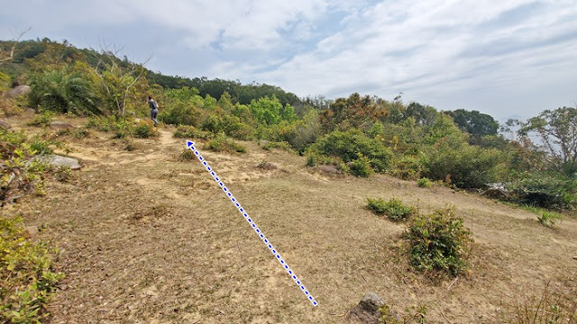
Head left here, towards Cape Collinson Road.

After 10 minutes or so on Cape Collinson Road, you will reach this point (there's a trail distance marker). Head right and you will soon arrive at Pottinger Peak View Compass (砵甸乍山觀景台) where the view is superb on a cloudless day. 

Once you are done with the view, keep going on the path which return to Pottinger Peak Country Trail.
But then, keep going straight on the dirt path.

Soon after, you will reach this other dilapidated battery.
From this point on, just follow the dirt path for about 1km or so.
There's going to be a steep and slippery down section. Be careful.

Then, you will reach this point. Take the stairs down on the right.

At the crossroads, take the steps down through the fence opening.
You will go through a cemetery. At the entrance of the cemetary, just keep going straight.
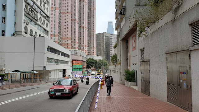
You will soon see the signs guiding you to the Chai Wan MTR. 


Sunday, March 6, 2022

Shek Lung Stream (石龍坑 ) to Tsuan Wan via Yuen Tsuen Ancient Trail

Duration:

(6.3 kilometers)
3h30m

Difficulty: 7/10 (mostly the stream part, rest is easier). 

Cel phone coverage: 100%

Water needs: 1.5 litre

Appreciation: 10/10

Transportation: Bus 234B or 53 from Tsuen Wan West MTR station (Bus terminus on top of station). Return via Tsuen Wan MTR.

Why it's worth it:


Map & Details: 


Exercise Area: No
---------------------------------------------


Get off at the Ting Kau stop. 
Go over the bridge behind you
Climb the little "bump" in the road, and take the road to the right...


... that road to the right...


About 15 minutes walk in, you'll see the waterfall which is the stream's entry-point

You need to cross the catch-water on the left of the waterfall, cross the waterfall, and climb-up on the right to bypass it. There's a visible footpath at the top. Then hop back in the stream

You'll reach this nice waterfall (石室瀑) and pool. Most likely will be dry-ish if it has not rained a lot.
Bypass is on the left as pictured. There's a yellow ribbon marking the bypass

The last, big waterfall is the Stone Dragon Waterfall (石龍飛瀑). Bypass is on the right.
The stream section is no more than 500m long

At the top of the bypass, you can go left to reach the top of the waterfall, snap a few pictures and come back. Head right to continue the hike.
After a minute or two walk from the last fork, you will be presented with this view and you will see a path going up on your left. Take the path on your left.


Go straight.

Slight left.

About 3.7km from the start of your hike (400m elevation), you will cross the Yuen Tsuen Ancient trail. Head right towards Tsuen Wan.

Keep right.

Left.

Straight.


Back in town. Tsuen Wan.

Left here, at the Adventist Hospital.

Left at D-Park and take the escalator. There's a long indoor corridor that will get you to Tsuen Wan MTR station.


Hike Hong Kong Web Site

HikeHongKOng on Facebook

Please, don't litter!

Hiking is about communion with nature. So please pickup after yourself. There's no excuse to leave plastic bags, water bottles or any rubbish on or around the trails; if you managed to bring it, you can manage to bring it back!