Showing posts with label intermediate. Show all posts

Tuesday, April 19, 2022

Devil's Claw Rock (魔爪石), Snoopy Rock (狗頭石), and Chung Hom Kok Battery (舂磡角舊炮台)

Duration: 4.5km (2h without stops)

Difficulty: 8/10. Going down to the Devil's claw is very slippery. 

Cel phone coverage: 90% 

Water needs: 1 liter. 30% shaded. 

Appreciation: 7/10. Little bit of history. A few Instagrammable rocks, if you are into this.


Exercise Area: No

Transportation: Take bus 6, 6X, 65, or 66 and get off at "Chung Hom Kok Beach; Chung Hom Kok Road" stop. Return via any of the multiple buses in Stanley's bus terminal.

Why it's worth it:


Monday, January 25, 2021

Wanchai to Stanley via Black's Link, HK Trail Section 4, Violet Hill, and the Twins

Duration:  11km (4h30)

Difficulty: 8/10. Lots of steps and for distance.

Cel phone coverage: Everywhere

Water needs: 2 liter. 70% shaded. 

Appreciation: 9/10. First kilometer is very very nice (look behind you!), but the rest is a bit boring.

Exercise Area: Yes

Transportation:  Wan Chai MTR exit 'A3'. Return to Admiralty/Central right at the end of the trail, across Stanley Gap Road via bus 6, 6A, or 6X. Or, go to Stanley for a bite with any bus (right on your left on Stanley Gap Road, at end of the trail)

Why it's worth it:


--------------------------------------
Right off Wan Chai Exit A3, cross and head right on Johnston road. 

After about 30m on Johnston road, head left onto Lee Tung street

Cross Queen's road and go up Spring Garden Lane.
You will see stairs in front of you

Take the stairs all the way up and head left onto Kennedy road


Cross Kennedy road at the pedestrian crossing. 

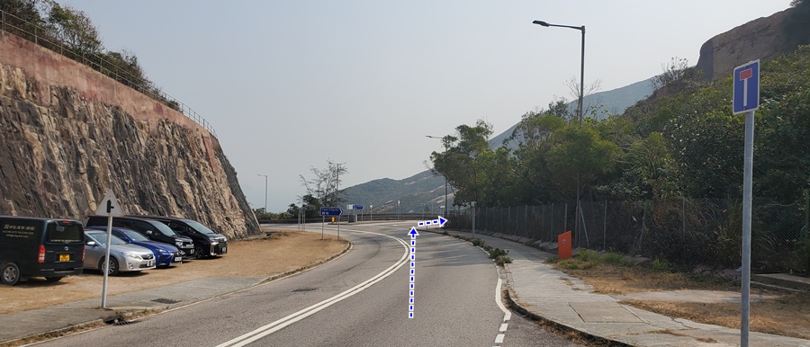
There will be a flight of stairs on your right with a signpost.
Get up the stairs. You will be going up on the stairs then path, for about 300m 

You will then cross the Bowen Road Fitness Trail at Orchid Valley (there are toilets there). Keep going straight and up, on  Wan Chai Green Trail

You will eventually reach Stubbs Road (about 350m), cross the road, and go up on Black's Link. 

Black's Link

Blac's Link will eventually merge into HK Trail Section4.
Just follow the path straight for a total of about 50-55 minutes and you will get to Wong Nai Chung Gap. 

Cross Wong Nai Chung Gap road and just follow the road around and under the bridge.

Immediately on the other side of the bridge, you'll see the petrol station with stairs just before it, which you must take.

Then head left at Tai Tam Reservoir Road after you climbed the stairs.
The brown-red buildings you see at a distance is Hong Kong Parkview Estate

After the pond on the right and just before you get to Parkview, there will be a trail map and stairs on the right. Take the stairs. The path will get you all the way up Violet hill. Take a look behind at intervals for views of the city. (BTW, there are toilets at the pond)

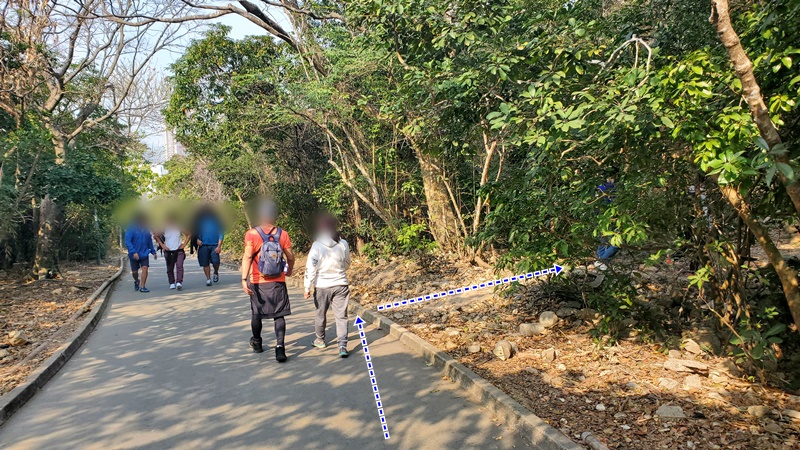
Only major fork that you should pay attention to at this point.
Head left towards Tsin Shui Wan Au 

Down from Violet Hill, with Repulse Bay on your right and the Tai Tam Intermediate Reservoir visible on your left

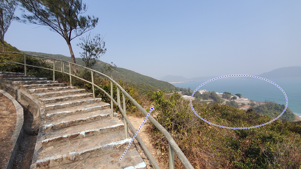
The last fork before the Twins. Cross the small bridge (Tze Kong Bridge) and head right and up the stairs on the right towards Stanley. The Tze Kong Bridge stone marker is encircled on the picture above. From that point on, you cannot get lost; it is a straight path with no forks. You will go up 950 steps, then down a bit, then back up to the second twin. Then finally down towards Stanley, which you will not reach as the trail stops at Stanley Gap road. There, you will have many bus options back to the city or to Stanley.


Monday, January 18, 2021

Not so Zimmerman's Loop section 6 ; more coast, more difficult, even prettier!

Duration:  11.5 km (4h)

Difficulty: 8/10. Flat for a good part but some bits are very steep, slippery, requiring rope assistance, and require some bushwhacking. Make sure you have good shows with grip, not flat soled running shoes. You can do the easier and official version, here: http://www.hongkonghikes.com/2021/01/zimmermans-loop-section-6-long-dragons.html

Cel phone coverage: Everywhere

Water needs: 2 liter. 50% shaded. 

Appreciation: 9/10. This is a "more coastal" version of Zimmerman's Loop section 6.

Exercise Area: Yes, at the very end.

Transportation:  Get to Shau Kei Wan MTR, exit A1. Then take bus #9 and get off at To Tei Wan - Dragon's Back stop. Return from one of the numerous buses at the Island Resort bus terminus.

Why it's worth it:


-----------------------------------

Bus #9 and get off at To Tei Wan - Dragon's Back stop. However, do not climb the stairs to Dragon's Back, nor down towards the To Tei Wan (beach). Instead, start your hike in the same direction of the bus, on Shek O Road

About 450m into the hike, leave Shek O Road, taking a right (second right), towards Cape D'Aguillar Road. Be careful as there is no sidewalk for the next 150m.

You will get tp a roundabout Private cars cannot keep going on D'Aguillar Road without special permits so, much safer from this point on.


About 15-20 minutes walk after the roundabout, you will reach this point with a road going to the left (first left). Take a left.


Another 20-30 minutes walk after your left turn on a slightly sloping road towards the peak, you will see a barrier on the road and a small building (the Cape D'Aguilar H.F. Radio Station). Just go around the building, on the right...

...all the way...

... around, and back on the road


You will eventually reach the 'Cape D'Aguilar Satellite Earth Station', that's where the road stops. Just go around the building's fences, on the left.

Keep going around and up.

Looks like a James Bond's villain's lair, doesn't it!?

You then start going in the bushes; not the characteristic rock...

... followed by more big rocks showing you the proper way.

About 300m from the Satellite Station building, you will reach this fork in the path (the ribbons might be gone), head right. 


In general, just follow the paths that go directly towards Shek O beach.
In the case above, there was a path on the left which was not the proper one.

Tricky here because the rock can be slippery. You can actually see the path down there, going through the bushes. Good shoes are a must!


Getting closer to Shek O beach


Left here. (Villagers have made some concrete steps)

Beach is right ahead.

Follow along Shek O beach and get back in the village at the car park.

At the roundabout, head left onto Shek O Road

You will walking straight on the same road...

... for about 1.5km (no turn)...

... until you reach the Big Wave Bay car park and bus stop.
Take the road to the beach, right by the bus stop.

Right

Another right in the village, towards the beach which is about 50m away at this point.

Walk along Big Wave Bay, to the boardwalk by the hill, and towards the lifeguard toward.

Go past the lifeguard tower.

Right after, you have an option to go check out the ancient rock carvings.
Well worth the 30 seconds detour.


Once done, keep going up the stairs, looking back from time to time to enjoy the view!

About 5 minutes up the stairs, you will reach this point where the stairs make a hard left and you can see the Cape Collinson Correctional facilities buildings on your right. You will see a clear dirt path on your right, going down. That's where the adventure begins. Be careful as some parts are quite steep and slippery.

Head right at the first fork.

At this point, keep going straight.

You will eventually make your way to the front of the Cape Collinson prison. 

Walk up Cape Collinson Road. Note that you will go by (on your right, about 220m after the prison's main gates) a path with ropes that go down to the Cape Collinson Battery searchlight. Worth a quick detour.

About 10-15 minutes from the prison's gate, you will reach this point where you have a shortcut on the right to the Dragon Trail. Take it. Then right on Dragon Trail road.

But, almost immediately on your right (about 20m), you will see a clear dirt path on your right.
You can decide to keep walk on the easy Dragon Trail, or take that adventurous path on the right which is slipperier, but prettier. Go ahead on the right!

At one point, you will reach this crevasse where a ladder will assist you down. At the bottom, head left and back onto Dragon Trail. Right onto Dragon Trail. You are quite close to the end of the trail at this point. 


Big buildings on the picture above is Island Resort, you final destination. There's a bus terminus underneath with tons of bus routes back to wherever you want to go.
Alternatively, you can continue on to Zimmerman's Loop Section 7: 
http://www.hongkonghikes.com/2020/12/zimmermans-loop-section-7-chai-wan-city.html


Hike Hong Kong Web Site

HikeHongKOng on Facebook

Please, don't litter!

Hiking is about communion with nature. So please pickup after yourself. There's no excuse to leave plastic bags, water bottles or any rubbish on or around the trails; if you managed to bring it, you can manage to bring it back!