7/10. Elevation gain is 260m
Cel phone coverage: Very sparse
Water needs: 2 liters. 10% shaded
Appreciation: 9/10. Very nice waterfalls, lots of pools to cool-off in.
Exercise Area: No
Transportation: Green minibus #33 from Yuen Long MTR (exit B). Return via Siu Hong MTR.---------------------------------
 |
Take the MTR all the way to Yuen Long. Exit 'B'. Then head right and walk along Long Yat Road. It will be a 5 minutes walk to Green Minibus #33.
|
 |
| You'll be turning right unto Shui Che Kwun Lane. You'll get to Shui Che Kwun road/Tung Tai Street. Keep right and straight on Tung Tai Street for about 50m. |
 |
You will see the minibuses lined up on your left, on Tai Fung street.
Green minibus #33 start from Tai Fung street
|
 |
The minibus ride is about 25 minutes. It is not the final stop so you may want to show the driver the Chinese characters in the image above, which stands for 'Ha Pak Nai Public Toilet'.
That is where you need to get off.
|
 |
| The stream is the one right next to the road. You can just walk the 100 or so meters on the road until it veers to the right. At this point, enter the stream. |
 |
You can see the first waterfall in the distance...
|
 |
The first waterfall, Silver Water Double Falls (銀水雙瀑).
About 1.3km into the stream, and 30 minutes to get there.
There's not much of a pool there to refresh yourself in. Waterfall bypass is on the left. |
 |
Next set of waterfalls. "Cascade on Stone Stage (石磐噴瀑)". Bypass is also on the left.
|
 |
That one has a nice, shaded, mini-beach. Good place for a soak!
|
 |
At this spot, the stream forks. Stay on the right.
|
 |
Then again here, stay on the right.
|
 |
Little gorge with a waterfall at the end (about 2.2km into the hike). "The Comb Waterfall Corridor (水梭瀑廊)". Can be bypassed on the right but it is much nicer to just walk in the water and the waterfall is an easy climb.
|
 |
| About another 100m in, the last waterfall. "The Slanting Slit Waterfall (斜縫瀑)" |
 |
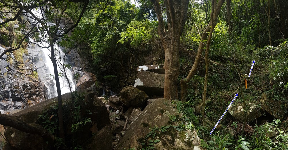
The exit point is another few hundred meters (about 3.3km into the hike).
It will be on your left, and quite obvious.
You'll also see these 3 big round boulders on the right, at the exit point.
|
 |
Path is obvious, no bushwhacking, but it is slippery.
You'll be climbing that path over a distance of about 300m.
|
 |
Then you will reach the trail proper, with a view of various towns below.
Head right. You'll go by the popular Instagram spot that is Lam Tei (一線脊) |
 |
Just about 100m out, you will climb a hill with the characteristics rock formations on the picture above. This is where you will start your descent back to civilization (Siu Hong MTR station)...
|
 |
... right here. It is slippery. Be careful.
|
 |
Keep going down. There will be a stream on your left.
It was so hot I took a few minutes to soak-in and cool-down!
Then it is a forested path that will get you to a paved road... |
 |
... the paved road.
|
 |
Once you get to Hong Po Road, you just have to follow-it for about 1km.
|
 |
... until you reach this point.
Cross the road and go through the little forested area on the right in the photo above.
|
 |
Almost at the MTR
|
 |
Left of the basketball court. You will see escalators on your right that will 'elevate' you to the concrete platform you see on the picture above. Walk atop for about 100m to Siu Hong MTR station...
|