Duration/時間: 6.5 hours, 13.5km. 6.5小時13.5公里
Difficulty/難度:
8/10. Hands required to climb some of the sections. Do not attempt if you are afraid of heights or don't feel comfortable scrambling. About 610m climb in total.
某些部分需要手攀爬。如果你怕高或不不擅長攀爬, 最好不要勉強嘗試。 總共攀爬約610m
8/10. Hands required to climb some of the sections. Do not attempt if you are afraid of heights or don't feel comfortable scrambling. About 610m climb in total.
某些部分需要手攀爬。如果你怕高或不不擅長攀爬, 最好不要勉強嘗試。 總共攀爬約610m
Cel phone coverage/手機覆蓋: Partial coverage. 部分地方訊號不足
Water needs/建議帶水: 2.5 liters. 2.5升
One of the most scenic hikes in Hong Kong.
香港其中一個風景最美的遠足遊
Transportation/交通:
Take bus 96R from Diamond Hill MTR exit C on Sunday or public holidays an exit at Pak Tam Au. Take speedboat or ferry at Chek Keng Pier to Wong Shek Pier and return via 96R.
星期日或公眾假期,從鑽石山地鐵出口C可乘坐96R巴士,在北潭凹下車。回程在赤角碼頭乘坐快艇或渡船至黃石碼頭,再轉96R巴士返回。
Why it's worth it/值得你去嗎?:


Map & Details:
Exercise Area: No
 |
Take 96R at Diamond Hill MTR station, drop off at Pak Tam Au.The trail head is on your right, across the road. There are toilets there shall you need them before you start. Have a quick look at my map. Not too hard to get your bearing. That is Maclehose section 2 by the way. 在鑽石山地鐵站乘坐96R巴士,在北潭凹下車。過馬路, 行山的路徑在你的右邊。 起程之前,如需要, 有廁所在附近. 看看我的地圖 , 很容易找到你的方位。這就是麥理浩徑第2段 |
 |
| First fork, go right. 第一個分叉,向右走 |
 |
| Then a left towards Chek Keng 跟住向左走, 往赤徑 |
 |
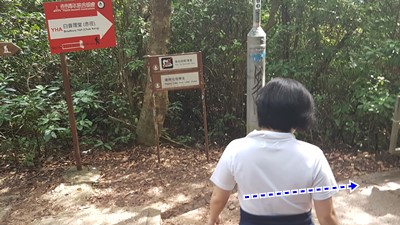
| At Chenk Keng, hang right. The path on the left goes to goes to the pier and the youth hostel 在赤徑, 轉在. 左邊的路是去碼頭和青年旅館的 |
 |
| Between milestone M40 and M39, about an hour in, you'll reach a little pavilion and a bench. That's where you break-off of Mac 2 and go up towards Sharp Peak. This is where the fun begins. You just have to follow the most direct path to the peak, Can't miss it. And yes, those steep patches are to be climbed... 大約一個小時後, 在里程碑M40和M39之間,你會到達一個小亭子和長凳。 那就是要和麥理浩徑第2段說再見 的地方,挑戰蚺蛇尖。 有趣的攀爬快要開始了。 你只需要遵循最直接, 向高峰路走便可。 是的,那些陡峭的地方是要手腳並用去爬的... |
 |
| Top of Sharp Peak 蚺蛇尖山峰 |
 |
| On the way back down, you can bypass the last steep pitch. From the top, just continue opposite from where you came from. It is a lot less steep. Then, you get to this point, turn right, and you'll be back to the trail. (We actually just went down the same way we came up) |
 |
| Then, instead of taking the same route back down, you will keep left on the mountain spine which goes right in between the leftmost beach (East beach) and Tai Long Wan. |

 |
| Only when you have reached the last hill does the path fork. East Beach to the left, and Tai Long Wan to the right. Take a right. |
 |
| Just keep going down towards Tai Long Wan. When you are there, walk about halfway through the beach. You will see an opening in the bushes on your right which you will take. The path will lead you to Ham Tin beach. (The next beach on the picture above, after the hill) |
 |
| Ham Tin Wan. Take a break , enjoy some food and refreshments. You can rent all sorts of beach gear at the store. If you are too tired to keep walking, you can talk to the store manager and book a boat back for about $150 per person. I personally think it's better to keep going and take the boat at the Sha Tau Pier which is cheaper ($20) and will be going by a fishing village. |
 |
| Once you are done soaking the sun at the beach, just zip through the store to the back and head left at the crossroad, following the path made of pavers. |
 |
| Just keep following the path for about 3km. After about 2km, you will have looped back to the junction where you climbed up to Sharp Peak. Unless you decide to go for another round, just keep going straight. |
 |
You'll get to those stairs at Maclehose milestone M042 (you see it on the left on the picture). Take them and you'll get to the Chek Keng pier. There are speedboats to take you to Wong Shek pier. $150 to charter one. Wait a few minutes for other hikers to join and make it cheaper (usually $20) |


