Duration:
5/10. Elevation gain is 520m. The last 500m has steeper downclimb on loose rocks and mild bushwacking.
Cel phone coverage: Full.
Water needs: 1.5 liter. Shaded throughout.
Appreciation: 8/10. You will get the classic Hong Kong harbour view from the Peak. Nice one to do when it is hot as the Peak's micro-climate keep it cooler.
Exercise Area: No
Transportation: Hong Kong station MTR. Return via Wong Chuk Hang MTR.
-----------------------------------------
 |
| Exit at IFC1 (the big mall atop Hong Kong MTR station) |
 |
| You can start at the escalator level, next to the 100QRC building. If you wait for 10:30 am, the escalator should be going up. Just follow the path of the escalator all the way to its end (~15 min, 1 km). |
 |
| Escalator ends here, on Conduit Road. Head right but stay on the left side of the road. |
 |
| After about a 300-400m walk, cross the street at the lights and go up on Hornsey Rd |
 |
You'll reach Old Peak Road after having walked about 600m.
Head left, take the stairs, and then keep going up on Old Peak Road. |
 |
Stay on your right here. Be on the lookout for a city boundary stone which will be on your right, about 50m further up.
This was the boundary of Victoria City in 1903 |
 |
| Another km on Old Peak Road and you'll reach this point, head right. You will go by a big red house on your left. |
 |
Almost at The Peak! Just a few meters left...
 |
| At The Peak, if you go left past the building, you'll get to the iconic Hong Kong harbour view. When you are done, retrace your step and go back to the top of the steps where you arrived at the Peak. |
 |
| Take the road on the right, that goes between the Peak mall, and the little house with a red roof. |
 |
| Just about 15m down on that road, take a right down the path with the fence (not sure why there's a fence there BTW |
 |
| Very pwetty... |
 |
| About an hour an 20 minutes into your hike (5k). Take a left. |
 |
| Take a left here so you can go to the Pok Fu Lam View Compass (5.5k) |
 |
| Go straight |
 |
| Nice view of Pok Fu Lam. Keep going afterwards. |
 |
| Left after the stairs |
 |
| Left, towards Aberdeen (6.6k) |
 |
| Right (6.7k) |
 |
| Follow Hong Kong Trail, on the left (you will see the trail marker stone) |
 |
| Left |
 |
| Left |
 |
| Left, follow the drainage canal |
 |
| Wildlife! |
 |
| Now, do not miss this one! At 11.15km, between 2:40 and 3:10 hours into the hike. If you miss it, you'll do a big detour. Take the steps down on the right. It is slippery and there's a rope but if you are careful, not very dangerous. |
 |
| Head right |
 |
| Follow the sign for Aberdeen Lower Reservoir |
 |
| Walk atop the dam |
 |
| At this junction, leave the path and continue following the water retention canal. 12k mark |
 |
| View of Wong Chuk Hang |
 |
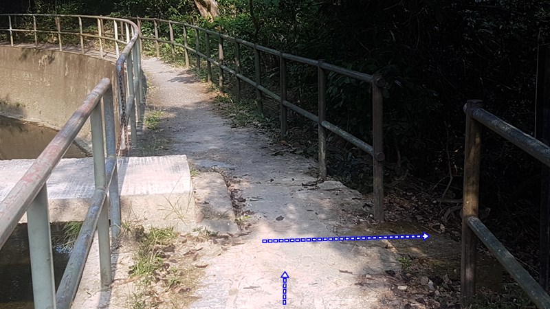
| Another one not to be missed as it is your exit point to Wong Chuk Hang; At 12.5k or about, keep an eye on the right for an opening that is marked with blue ribbons. It is overgrown and mild bushwhacking is required. But there are tons of ribbons so you should not get lost. Just make sure you get there before nightfall. |
 |
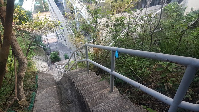
| Finally! Civilization! Down the stairs... |
 |
| Take the overpass. |
 |
| Nice in a retro-futuristic kind of way... |
 |
| Left |
 |
| Wong Chuk Hang MTR. Hope that was fun! |
|