Showing posts with label bushwhacking. Show all posts

Tuesday, March 2, 2021

High Island Reservoir Dam loop via Po Pin Chau (破邊洲) and Pak Lap (白腊)

Duration:  6km (2h to 3h depending on the amount of picture taking)

Difficulty: 5/10. 232m elevation gain. Easy but be very cautious walking by the cliffs.

Cel phone coverage: None

Water needs: 1.5 liter. Not shaded. 

Appreciation: 10/10

Exercise Area: No

Transportation:  From SaiKung, takes the Taxi to the East Island Dam. Stop at the blue "anchor" (High Island Reservoir Monument - 紀念碑(萬宜水庫)). Return on cab to SaiKung or, via Minibus 9 between 3pm and 5pm, in front of the monument . About $125 cab fare one-way.

Why it's worth it:

----------------------------------
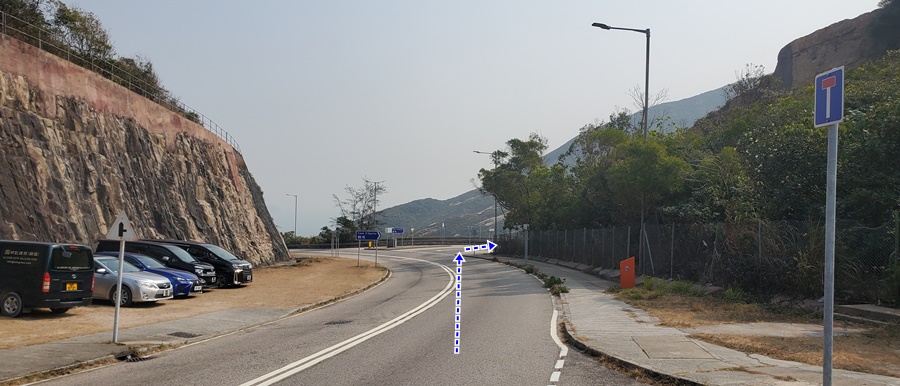
The taxi will drop you off at the blue 'anchor' stone, just before the High Island East Dam. Take the stairs just 75m before anchor.


The path is well marked, you cannot really go wrong.


About 15 minutes, 420m into the hike. #1 on the map above.

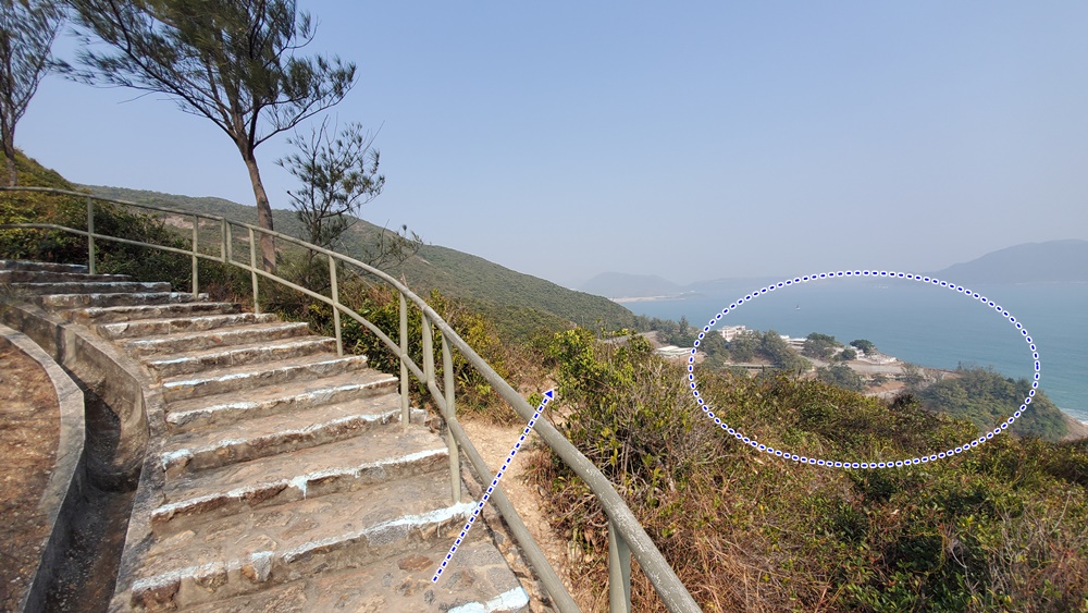
Another 200m. #2 on the map above. You are climbing towards Po Pin Chau.

Watch where you step!

Po Pin Chau in all of its glory. Retrace your steps when you are done marveling at its beauty...

Back at the fork marked by #2 on the map above, go left this time.

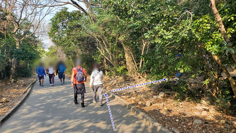
After another 50m or so, you will reach this fork. If you go straight, it is the most-walked path but then you will miss some of the nicer views. Head left for the scenic, yet a bit bushwhacky path. 


Just keep following the path which hugs the coast. All the way to the stone sculptures/assemblies.

Go down on your right, while still staying on the path following the coast.

Cross the stream, and keep on the same path to the left.


About 3km into the hike, almost at Tsat Chung pebble beach

Across Tsat Chung beach, and up the hill.

Then pretty much just follow the path until you reach Pak Lap. Head left for a quick peak at Pak Lap beach, and some food there...

When you are done, cross Pak Lap village (there's a concrete path)

Then, pretty obvious path that will take you up back on Sai Kung Man Yee Road (Mac 1), head right and loop back to your starting point.


Monday, January 18, 2021

Not so Zimmerman's Loop section 6 ; more coast, more difficult, even prettier!

Duration:  11.5 km (4h)

Difficulty: 8/10. Flat for a good part but some bits are very steep, slippery, requiring rope assistance, and require some bushwhacking. Make sure you have good shows with grip, not flat soled running shoes. You can do the easier and official version, here: http://www.hongkonghikes.com/2021/01/zimmermans-loop-section-6-long-dragons.html

Cel phone coverage: Everywhere

Water needs: 2 liter. 50% shaded. 

Appreciation: 9/10. This is a "more coastal" version of Zimmerman's Loop section 6.

Exercise Area: Yes, at the very end.

Transportation:  Get to Shau Kei Wan MTR, exit A1. Then take bus #9 and get off at To Tei Wan - Dragon's Back stop. Return from one of the numerous buses at the Island Resort bus terminus.

Why it's worth it:


-----------------------------------

Bus #9 and get off at To Tei Wan - Dragon's Back stop. However, do not climb the stairs to Dragon's Back, nor down towards the To Tei Wan (beach). Instead, start your hike in the same direction of the bus, on Shek O Road

About 450m into the hike, leave Shek O Road, taking a right (second right), towards Cape D'Aguillar Road. Be careful as there is no sidewalk for the next 150m.

You will get tp a roundabout Private cars cannot keep going on D'Aguillar Road without special permits so, much safer from this point on.


About 15-20 minutes walk after the roundabout, you will reach this point with a road going to the left (first left). Take a left.


Another 20-30 minutes walk after your left turn on a slightly sloping road towards the peak, you will see a barrier on the road and a small building (the Cape D'Aguilar H.F. Radio Station). Just go around the building, on the right...

...all the way...

... around, and back on the road


You will eventually reach the 'Cape D'Aguilar Satellite Earth Station', that's where the road stops. Just go around the building's fences, on the left.

Keep going around and up.

Looks like a James Bond's villain's lair, doesn't it!?

You then start going in the bushes; not the characteristic rock...

... followed by more big rocks showing you the proper way.

About 300m from the Satellite Station building, you will reach this fork in the path (the ribbons might be gone), head right. 


In general, just follow the paths that go directly towards Shek O beach.
In the case above, there was a path on the left which was not the proper one.

Tricky here because the rock can be slippery. You can actually see the path down there, going through the bushes. Good shoes are a must!


Getting closer to Shek O beach


Left here. (Villagers have made some concrete steps)

Beach is right ahead.

Follow along Shek O beach and get back in the village at the car park.

At the roundabout, head left onto Shek O Road

You will walking straight on the same road...

... for about 1.5km (no turn)...

... until you reach the Big Wave Bay car park and bus stop.
Take the road to the beach, right by the bus stop.

Right

Another right in the village, towards the beach which is about 50m away at this point.

Walk along Big Wave Bay, to the boardwalk by the hill, and towards the lifeguard toward.

Go past the lifeguard tower.

Right after, you have an option to go check out the ancient rock carvings.
Well worth the 30 seconds detour.


Once done, keep going up the stairs, looking back from time to time to enjoy the view!

About 5 minutes up the stairs, you will reach this point where the stairs make a hard left and you can see the Cape Collinson Correctional facilities buildings on your right. You will see a clear dirt path on your right, going down. That's where the adventure begins. Be careful as some parts are quite steep and slippery.

Head right at the first fork.

At this point, keep going straight.

You will eventually make your way to the front of the Cape Collinson prison. 

Walk up Cape Collinson Road. Note that you will go by (on your right, about 220m after the prison's main gates) a path with ropes that go down to the Cape Collinson Battery searchlight. Worth a quick detour.

About 10-15 minutes from the prison's gate, you will reach this point where you have a shortcut on the right to the Dragon Trail. Take it. Then right on Dragon Trail road.

But, almost immediately on your right (about 20m), you will see a clear dirt path on your right.
You can decide to keep walk on the easy Dragon Trail, or take that adventurous path on the right which is slipperier, but prettier. Go ahead on the right!

At one point, you will reach this crevasse where a ladder will assist you down. At the bottom, head left and back onto Dragon Trail. Right onto Dragon Trail. You are quite close to the end of the trail at this point. 


Big buildings on the picture above is Island Resort, you final destination. There's a bus terminus underneath with tons of bus routes back to wherever you want to go.
Alternatively, you can continue on to Zimmerman's Loop Section 7: 
http://www.hongkonghikes.com/2020/12/zimmermans-loop-section-7-chai-wan-city.html


Hike Hong Kong Web Site

HikeHongKOng on Facebook

Please, don't litter!

Hiking is about communion with nature. So please pickup after yourself. There's no excuse to leave plastic bags, water bottles or any rubbish on or around the trails; if you managed to bring it, you can manage to bring it back!