Showing posts with label 4 hours. Show all posts

Sunday, November 10, 2019

San Uk Ka (Tai Po) to Shing Mun Reservoir (Tsuen Wan) via Lead Mine Pass and Needle Hill (針山)

Duration: 
11km (4 hours)

Difficulty: 
6.5/10. Elevation gain is 620m 

Cel phone coverage: Full.

Water needs: 1.5 liter. Mostly shaded except for the Needle Hill ascent part

Appreciation: 8/10


Exercise Area: No

Transportation: Tai Po Market MTR exit 'B'. Green minibus 23K. Return via Green Minibus 82M to Tsuen Wan MTR.

Why it's worth it: 
---------------------------------
Take the MTR all the way to Tai Po Market station. Get out at Exit 'B', you will see the bus terminus on the right, right off the MTR station. Take the 23K which comes by quite frequently.

You will get out at the terminus (the minibus will actually backtrack, and return on Wun Yiu road). Easy to know you have arrived because everybody's getting off, and there's these children play structures on the left of the terminus.

Keep going on Wun Yiu road.

About 7 minutes and 300m into the hike, head right. Path on the left just goes to the river.

Another 100m farther  and you'll get to this fork, follow Lead Mine Pass on the left. This is still Wun Yiu road.

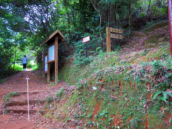
Left again at the Wilson Trail map (you are on the Wilson trail at this point BTW)
Head right

At Wilson trail W087 marker, 850m into your hike, you'll see stairs on the right which you must take. You will see quite a few paths on the left and right over the next few hundred meters. These go to burial sites. Just keep straight on the path

Left

You'll go by a waterfall, on your right

About 1 hour and 2.7km into your hike, you'll reach the toilets and gazebo at Lead Mine Pass.

Go left at the gazebo, towards Tai Po Kau
You are now on Maclehose trail

Follow Needle Hill/Grassy Hill

Lots of signage, can't really get lost

About 1h45min and 5.6km into your hike, you'll reach this fork with a view of Needle Hill ahead. Head left


Head right

Head left toward Needle Hill


Needle Hill, ever larger in front of you... Quite a few steps but nothing too hard

At the top! Then go down the other side

You've reached the road, with the dam in front of you. You can take the path on the left, or go straight as there's a flight of stairs providing a shortcut. Cross the dam. Then, just follow the paved road all the way

Keep following the road until you reach the Pineapple dam which will be on your right. That is where Green Minibus 82M's terminus is (right in front of the stairs). 82M will get you back to Tsuen Wan. 

Monday, August 27, 2018

Dai Shek Stream (大石石澗)

Duration: 
10km total. About 1km in the stream

Difficulty: 
10/10. Would strongly advise not to do that stream unless you have a lot of experience stream-trekking, are comfortable with rock-climbing, and will be extremely watchful of loose rocks. There has been a few fatalities on that trek. It is the most dangerous one I have taken part of, due to the loose rocks which can not only cause one to fall, but also, is dangerous for people following. Out of our party of 8, 5 fell or slid during that trek. With one falling about 3 meters.

Cel phone coverage: Sparse.

Water needs: 2 liter.

Appreciation: 9/10. Lots of waterfalls. 


Exercise Area: No.

Transportation: Tsuen Wan West MTR, Exit A1. Bus 51, Shek Kong Village stop. Return via bus 51 at Route Twisk.

Why it's worth it: 

----------------------
Tsuen Wan West MTR. Go out at exit A1 and up to the bus terminus. Take bus 51. 


After about 20-25 minutes bus ride, alight at the 'Shek Kong Village' stop. Then retrace your steps a bit...
… and cross the road as the "path" is on the left side.


After 5-7 minutes walk, you'll see a bunch of small concrete pillars on the left, at a turn in the road, as well as a rain catch.
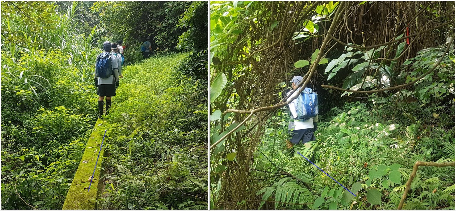
This is where you enter. Walk on the concrete catch.

There's a sign stating the obvious. At this point, if you feel uncomfortable continuing, DON'T !
There is no shame in aborting. Don't be peer pressured.

Keep on the catch-water concrete structure. It will stop, keep straight. You will see a red ribbon, go slightly left.
You should hear the stream.

Refer to the big slanted tree. In any case, the stream is right ahead of you. 
Careful, slippery

Ribbons. Not always very visible because the colors are worn-off

Another catch-water structure on the way down to the stream. 
You are about 30m away from the stream, which you should hear clearly by now.

You should be entering the stream about here. 
No real chance to get lost. Just go up the stream and stay right at any of the forks
Bypasses are generally quite obvious but beware of loose rocks. Always keep 3 points of contact, and test your anchor points; make sure it is firmly secured to the ground and not brittle. Most of the tall waterfalls are bypassed on the right.
Climb on the right of this one. Most of the holds are actually roots
Climbing on the right. This gives you have good idea of the difficulty level.
Still bypassing on the right.
After a few more easier waterfalls, the stream dies out and you basically will be just walking on rocks. Just keep going straight up and you will get out of the woods and close to the top of a hill.
Climb the hill just enough so you can see behind to your right...
… you should see poles/pylons. The trail is there. On a weekend, there should be quite a few hikers there. You may have to bushwhack your way there but it is at most 150m.
You are mostly home-safe! Go right on the path, towards the weather-radar station's dome. Then, follow the path all the way down to Road Twisk (about 5km) where you will see the bus 51 stop which will bring you back to Tsuen Wan/Tsuan Wan West MTRs

Monday, March 12, 2018

Ng Tung Chai (梧桐寨) to Shing Mun reservoir (城門水塘) via Tai Mo Shan (大帽山)

Duration: 
10k, 4 hours

Difficulty: 
7/10. 635m elevation gain. 

Cel phone coverage: Very sparse.

Water needs: 1.5 liter.

Appreciation: 10/10. Nice forested hike, tons of waterfalls, views from Tai Mo Shan. 

Exercise Area: No.

Transportation: MTR to Tai Wo, exit A. Bus 64K. Return to Tsuan Wan MTR via minibus 82

Why it's worth it: 

--------------------------------


Take Exit 'A' (Tai Wo Plaza) out of the Tai Wo MTR station. Head left.

There will be a set of escalators on your right, leading to the bus stops.

The KMB 64k stop is on the other side of the first road lane. Don't go all the way on the other side because you'd take the 64k to Tai Po Market.

Yeah, that one...

The bus stops just in front of the Ng Tung Chai road (the stop is actually called Ng Tung Chai so, you can't miss it)

Keep following the road, don't be tempted to stray. You'll be walking on that road to Ng Tung Chai for about 10-15 minutes.

When you are in the vicinity of Ng Tung Chai, you will see a path heading up (to the right). Take it.

Go by the front of the house of barky dogs.

Go straight to the rock-paved path. This will lead you to the temple. About 20 minutes walk there.

At the temple, keep going straight. The trail officially starts there.

Don't take the Scatter Fall path. There signage announcing the falls so you can't miss them.
The bottom fall is about 35-40 minutes in.

Bottom fall
Middle fall
Main fall. The tallest in Hong Kong at 35m. Once done contemplating, take the path up and to the left of the falls.
After some scrambling, you'll come to Scatter falls. 
About 4.3km into your hike, you'll reach this fork. On the right, you would loop back to temple.
Take left towards Tai Mo Shan where the fun is!
Bamboo forest... nice!
Walk another 200m, you'll reach another fork. Take the path on the left
You have reached the highest point of your hike.
Not quite the top of Tai Mo Shan, which you can see on your right, but still..
Once rested, find the unmarked path down the mountain, pretty much across from the path you came from. It may be a bit overgrown but don't worry, that's the right way. There should be some colored ribbons along the way
Right at the fork. You'll cross a stream just a few tens of meters farther. Head left after the stream.
I won't point them out here because they are not super obvious and don't want you to get lost, but there are quite a few more waterfalls that can be reached from that path (refer to the Tai Shing stream trek)
Head right at the gate. Left will also get you there but my hiking party was a bit tired at this point.
Down, around, and right
Down left, and then through the picnic area.
Down the stairs, head right. Over the bridge, then right again


That's it, minibus stop which will bring you back to Tsuen Wan


Hike Hong Kong Web Site

HikeHongKOng on Facebook

Please, don't litter!

Hiking is about communion with nature. So please pickup after yourself. There's no excuse to leave plastic bags, water bottles or any rubbish on or around the trails; if you managed to bring it, you can manage to bring it back!