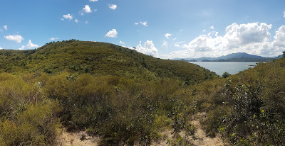
15km (5 hours)
Difficulty:
7/10. Elevation gain of 450m
Cel phone coverage: Almost none.
Water needs: 2 liters. 50% shaded
Appreciation: 8/10. Nice forested path will have you go through the villages of Pak Sha O, Nam Shan Tung, Lai Chi Chong, and Sham Chung.
Map & Details: https://www.mapmyhike.com/workout/4470045967/
Exercise Area: No
Return to Sai Kung via bus 99, or 299.
Why it's worth it:
 |
| The Pak Sha O youth hostel entrance. |
 |
| Head left |
 |
| A few minutes later, you will arrive at Lai Chi Chong village. |
 |
| In no more than 15 minutes, you will have reached the beach |
 |
| At this point, you can retrace your steps to the 'A-B' junction, or keep walking on the beach ('B' path) |
 |
| You will eventually re-join the main path that path 'B' would have also led you to. Head right towards Sham Chung. That point is at 6.5km into your hike. |
 |
| Shum Chung Manor |
 |
| Yung Shue O village. Head right. About 10.9km into the hike |
 |
| At ~14.5km into the high, you'll reach this junction, head right. You are about 500m away from the bus stop at this point. |

 |
| Turn left on that road (Sai Sha rd); the bus stop is 100m ahead. |


