Sunday, February 8, 2015

Tung Chung to Discovery Bay (via Tiger Head Lo Fu Tau/老虎頭)

Duration: 
(12 kilometers)
3.25 hours

Difficulty: 6.5/10. Not very difficult except for the last descent which can be a bit treacherous. Do not go if it just rained. Good shoes are a must. 

Cel phone coverage: Everywhere

Water needs: 1.5 liter

Appreciation: 6/10. First half is boring. Second half is very scenic.

Transportation: MTR to Tung Chung. Return via ferry or various buses.

Why it's worth it:

Garmin: http://connect.garmin.com/modern/activity/692426783
---------------------------------------
Get out at Exit 'B' and get in the mall

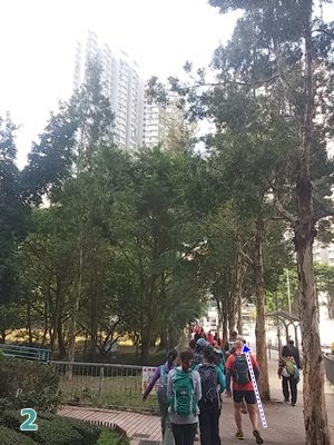
Get up the escalators...

Then up again...

Go through the section that goes over the road 

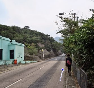
Immediately down the stairs on the right, as soon as you are out


Right on Hei Tung street

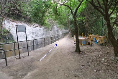
Gap by the fence...

About one kilometer by the sea and train tracks

Go in the tunnel

Right


You are about halfway (the 6km mark or so), if you go straight, the path goes to Mui-Wo. But we're heading left towards Disco-Bay. Much prettier trail too.

Views of the Discovery Bay golf course

Atop the Tiger Head. The path forward goes down but is steep and slippery

All done with the slippery bit. Head left


You're in Discovery Bay now. Under the arch is a mall and through, you'll get to Discovery Plaza. Ferry and buses are right there. Hope that was fun...

Sunday, February 1, 2015

Hong Kong Trail Section 7

Duration: 
(8 kilometers)
2 hours

Difficulty: 3/10. Flat all the way but for steps on the last 500m

Cel phone coverage: Everywhere

Water needs: 1 liter

Appreciation: 5/10. Pretty much walking by water catchment all along. Some occasional nice views. Beaches but not the most attractive ones. I don't think I will return to this one.

Transportation: Citibus 14 from Sai Wan Ho (Exit A). Return via bus #9 to Shau Kei Wan

Why it's worth it:

Garmin: http://connect.garmin.com/modern/activity/687307861
---------------------------------------
Take Bus 14 right off Exit 'A' at Sai Wan Ho MTR station. Get off at Tai Tam Reservoir (North) stop.
Then retrace your steps for about 100 meters. Be careful, there's no sidewalks for the last 25 meters.

Take the path going down on the right. You will see the trail map on the other side of the road

Then quite trivial; just follow the water catchment pretty much all the way...


6.5km in, you'll see this intersection, if you go to the right, you'll arrive at a little beach. Nothing much to see there but if you feel like it... HK Trail Section 7 continues on the left...

At To Tei Wan. Not the best of beaches (quite a lot of pebbles)

Once done beaching, just continue up the stairs to the road. Only 500m to go but all stairs

You'll get to the road. Bus #9 on your side of the road will get you back to the MTR

Sunday, January 11, 2015

The Hunch Backs - Ngau Ngak Shan (牛押山)

Duration: 
(17 kilometers)
7 hours

Difficulty: 9/10. First 2km are really steep, will often require your hands. Paths down are often slippery. Not good if you are afraid of heights. Long hike

Cel phone coverage: Most of the trail.

Water needs: 2 liters

Appreciation: 10/10. Amazing view. Walking on the peak of the razor-sharp mountains is exhilarating 

Transportation: Easy access. Wu Kai Sha MTR, then return via Wong Tai Sin MTR

Why it's worth it:


Garmin: http://connect.garmin.com/modern/activity/670511749
---------------------------------------
Make your way to the Wu Kai Sha MTR. Exit towards the LakeSilver escalators. Head left through the bus terminus. You should end up on Sha On Street...

Cross the street and head right.

Walk along the road to your right and green-space on your left...

Until you reach this point where there's a path on the left going through the green-space. Take the path.

Follow the path all the way through the green-space and underneath the highway overpass. Right after the overpass, hear left on the path.

You'll be walking a few meters on that path until you see a water drainage trench on your right. This is where the "trail" proper starts. Go up on the right of the trench.

Maybe 10-15 meters in, you'll see an actual beaten path on the right. This is where the fun begins. Take that path and start scrambling up.

You'll eventually reach this crossroad, take the path on the right.

Another crossroad. Go straight
You will essentially be climbing the dorsal fin of the mountain

At times, there'd isn't much between you and a steep drop. But the views are amazing

View of the first peak, Ngau Ngak Shan, from the second one, Ma On Shan.Keep following the trail until you reach section 4 of Maclehose. Then go South on Maclehose 4 and keep following it.

Here, straight ahead. Still on Mac 4. About halfway through I would say.


Road towards Shatin pass. At Shatin pass, you can replenish but you only have about 40 more minutes to Wong Tai Sin. Just keep going down the road.

Hike Hong Kong Web Site

HikeHongKOng on Facebook

Please, don't litter!

Hiking is about communion with nature. So please pickup after yourself. There's no excuse to leave plastic bags, water bottles or any rubbish on or around the trails; if you managed to bring it, you can manage to bring it back!