Showing posts with label n.t.. Show all posts

Sunday, September 25, 2016

Hong Kong Mini Grand Canyon, Po Lo Shan - Pineapple Mountain (菠蘿山)

Duration: 

75 minutes

Difficulty: 3/10

Cel phone coverage: Everywhere

Water needs: 1 liter

Appreciation: 6/10. Don't have too high expectations, the "Grand Canyon" is quite small. I also don't like the return access which is via an infrequent minibus

Transportation: Red light rail #505 to Leung King Light Rail MTR station from Siu Hong MTR station on West Rail line. Return via minibus at Ha Pak Lai

Why it's worth it:
-----------------------
Take the West Rail MTR line and get off at Siu Hong. Then take red light rail #505 and alight at Leung King. Cross the tracks, and you will be in front of Leung King Plaza. 

Go around Leung King Plaza (on the right)


You'll see a little walkway that gets you to a road, where you head left.
No major risk of getting lost there, the village is so small.

Just walk along the road...

... until the road curves to the left and, to your right, you'll see a path going up the hill.
That's the beginning of the trail.

The PLA area gates might be closed, just go around. From that point on, you just have to follow the main trail (don't divert via any side-trail which may be going up mountains or hills). You'll go up for maybe 30 minutes and then down towards the canyon.

And eventually the path will get you here. Be careful at the edges

Once you're done, keep going, following the path down towards Ha Pak Lai.
You'll get to this point where the PLA is informing you that you essentially have gone all rogue and illegal.
Head right

Then left here towards the village and the minibus terminus.
The terminus is a good 10 minutes walk away

The beach, on your right, along the way to the minibus.
Quite dirty and stinky, but good for sunset pictures

There you go, minibus stop. Usually busy on weekend around sunset time


Monday, May 20, 2013

Devil's peak in Yau Tong


Duration: 
(4.4 kilometers)
1 to 1.5 hours
Difficulty: 3/10.
Appreciation: 8/10. Nice views of the harbour from unusual angle. A quick and easy hike to nice views and old WWII bunkers.

Transportation: Yau Tong MTR exit A1, there and back.

Why it's worth it:


Garmin: http://connect.garmin.com/activity/314877376
---------------------------------------
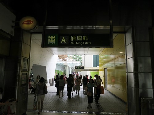
Get out at Yau Tong MTR Exit A1
Walk towards Lei Yue Mun road.


Head right on Lei Yue Mun road

Walk towards the roundabout. Cross the street and head left on Ko Chui Rd

Follow the blue signs announcing the cemetery. That's actually MacLehose section 3

About 500m of slight ascent on the road leading to the cemetery, you'll see a sign for  Maclehose.
Cross the street and climb the stairs


You will be walking around devil's peak for a while and by the cemetery.
You will have a good look of the peak on your left.

Once you get here, turn around and retrace your steps around the peak.

You can cut through the wood or keep walking and take path to the right.

Climb.

Almost at the top. WWII barracks. Devil's Peak stands at 222 metres in height. To the east of the peak lies Tseung Kwan O and Yau Tong lies to its west. The area around the peak was garrisoned by the British Army or local pirates to control the passage of Lei Yue Mun, which is an important nautical passage in South China. The remains of a redoubt and batteries are still visible on the peak.

Quite large walls.
Great views. When your done. Head back down.


Basically retrace your steps back to Yau Tong MTR


Monday, March 25, 2013

East Island dam coastal hike


(updated 2021-03-01) 

Duration: 
(7 kilometers)
3 hours

Cel phone coverage: None

Water needs: 2 liters. Not shaded.

Difficulty: 7/10 because there's some steep descents.
Appreciation: 10/10. Nice views, nice beach. Amazing views on part of Hong Kong Geopark.

Map & Details: 

Exercise Area: No

Transportation: From SaiKung, takes the Taxi to the East Island Dam. Stop at the blue "anchor" (High Island Reservoir Monument - 紀念碑(萬宜水庫)). Return on cab to SaiKung. About $125 cab fare one-way.

Why it's worth it:

---------------------------------------
Start at the powder-blue, anchor like thing right before the East dam.


If you trace back your steps on the road for 25 meters or so, there a set of stairs to climb.


Can get quite steep on the way down.

Follow the coast. Lots of sandstone.


Can't really get very lost if you keep following the coast. Print the Garmin map to be safe.
Nice views
You'll go by the two pebble beaches.

Back to bushwhacking after the 1st beach.

Village on the right. Go straight.


The cave option.
Pak Lap beach in sight
Pak Lap beach. There's a restaurant there.


Back on actual trails.
Sha Kiu Tau where you head back towards the reservoir road.

At reservoir road. Hail a cab from there.


Hike Hong Kong Web Site

HikeHongKOng on Facebook

Please, don't litter!

Hiking is about communion with nature. So please pickup after yourself. There's no excuse to leave plastic bags, water bottles or any rubbish on or around the trails; if you managed to bring it, you can manage to bring it back!