Showing posts with label 城門水塘. Show all posts

Monday, March 12, 2018

Ng Tung Chai (梧桐寨) to Shing Mun reservoir (城門水塘) via Tai Mo Shan (大帽山)

Duration: 
10k, 4 hours

Difficulty: 
7/10. 635m elevation gain. 

Cel phone coverage: Very sparse.

Water needs: 1.5 liter.

Appreciation: 10/10. Nice forested hike, tons of waterfalls, views from Tai Mo Shan. 

Exercise Area: No.

Transportation: MTR to Tai Wo, exit A. Bus 64K. Return to Tsuan Wan MTR via minibus 82

Why it's worth it: 

--------------------------------


Take Exit 'A' (Tai Wo Plaza) out of the Tai Wo MTR station. Head left.

There will be a set of escalators on your right, leading to the bus stops.

The KMB 64k stop is on the other side of the first road lane. Don't go all the way on the other side because you'd take the 64k to Tai Po Market.

Yeah, that one...

The bus stops just in front of the Ng Tung Chai road (the stop is actually called Ng Tung Chai so, you can't miss it)

Keep following the road, don't be tempted to stray. You'll be walking on that road to Ng Tung Chai for about 10-15 minutes.

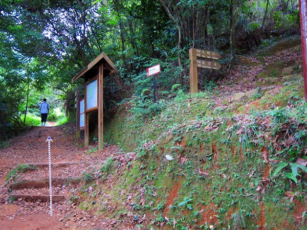
When you are in the vicinity of Ng Tung Chai, you will see a path heading up (to the right). Take it.

Go by the front of the house of barky dogs.

Go straight to the rock-paved path. This will lead you to the temple. About 20 minutes walk there.

At the temple, keep going straight. The trail officially starts there.

Don't take the Scatter Fall path. There signage announcing the falls so you can't miss them.
The bottom fall is about 35-40 minutes in.

Bottom fall
Middle fall
Main fall. The tallest in Hong Kong at 35m. Once done contemplating, take the path up and to the left of the falls.
After some scrambling, you'll come to Scatter falls. 
About 4.3km into your hike, you'll reach this fork. On the right, you would loop back to temple.
Take left towards Tai Mo Shan where the fun is!
Bamboo forest... nice!
Walk another 200m, you'll reach another fork. Take the path on the left
You have reached the highest point of your hike.
Not quite the top of Tai Mo Shan, which you can see on your right, but still..
Once rested, find the unmarked path down the mountain, pretty much across from the path you came from. It may be a bit overgrown but don't worry, that's the right way. There should be some colored ribbons along the way
Right at the fork. You'll cross a stream just a few tens of meters farther. Head left after the stream.
I won't point them out here because they are not super obvious and don't want you to get lost, but there are quite a few more waterfalls that can be reached from that path (refer to the Tai Shing stream trek)
Head right at the gate. Left will also get you there but my hiking party was a bit tired at this point.
Down, around, and right
Down left, and then through the picnic area.
Down the stairs, head right. Over the bridge, then right again


That's it, minibus stop which will bring you back to Tsuen Wan


Tuesday, June 5, 2012

Tai Shing Stream (大城石澗)


Register and get cash back:
http://amex.com.hk/refer/jEANCCqqi5?CPID=100433829

Why it's worth it: 
Lower section

Upper section

Upper section
---------------------

Duration: 
Option 1 (whole stream):
Pineapple dam minibus stop to stream (bridge): 35 minutes. 1.7k
Stream: 4-4.5 hours. 2.5k. Add time for bathing in the pools, lunch, rest, etc...
Hike back to minibus at dam: 1.25 hour, 4.5k
Total: 6.5 hours

Option 2 (upper section of stream):
Pineapple dam minibus stop to stream (upper section): 1 hour. 2.6k
Stream: 2.5 hours, 1.3k

Hike back to minibus at dam: 1.25 hour, 4.5k
Total: 4.75 hours


Option 3 (lower section of stream):
Pineapple dam minibus stop to stream (bridge): 35 minutes. 1.7k
Stream: 1.5-2 hours, 1.2k
Hike back to minibus at dam: 1 hour, 2.6k
Total: 3-3.5 hours

Garmin GPS route: 
Option 3: http://connect.garmin.com/player/199283306
Option 2: http://connect.garmin.com/activity/206775509

Difficulty: 
Option 1 (whole stream):
8/10. Quite long time in the stream and some sections are harder to negotiate.

Option 2 (upper section of stream):
7/10. Some sections are harder to negotiate.

Option 3 (lower section of stream):
6/10. Not very hard. Still stream trekking though so it is more challenging than regular hiking.


Cel phone coverage: Rare coverage. Even on trail coming back.

Water needs: 2 liters.

Appreciation: 7/10 lower part of the stream,9/10 higher part. 10/10 overall with the trail to the stream with butterflies and all. After the second portion of the stream, the waterfalls density and height increase. The water is not as clean as stream such as Wong Lung Hang but enough for a swim. Water flow's best after a good week of rain, otherwise, might be just trickles. Note that the pineapple dam trail is in itself quite nice.

Transportation: Green Minibus 82 will get you right at the beginning of the trail at Pinneapple Dam  (Shing Mun Reservoir). 

-------------------
Take the MTR to Tsuen Wan station. Exit B1. Then go straight.

(1) You'll pass the garden down on your right, then arrive here, in front of the red building. Go down the stairs on the left. Then turn right at the first street on the same block. Right again on Shiu Wo Street.

Minibus 82 is right there at the corner. There are quite a lot of them so, you'll quickly be on your way.


(2) No need to "yau lau" the driver for this one, minibus 82 's terminus is at the Pineapple dam which is your trail's starting point. Right off the bus, climb the stairs.

Follow the Pineapple Dam nature trail. Quite nice actually with the cicadas singing their heart's content and the butterflies in large number.

(3) At the top of a bunch of steps, about 15 minutes, you will reach the road. Head right.

(4) 35 minutes from start of the trail, you'll reach a BBQ area with a pavilion on the right and toilets on the left.
This is where you get your first option. You can head towards the toilets shack, which is option 2, then jump to Option 2. Or keep going on the road towards the bridge, that's option 1 & 3 below.
---- Option 1 & 3 ----
(7)  Altitude 190m. After a 2 minutes walk from the toilet shack/BBQ site, you'll reach a bridge  going over the the Tai Shing stream. You get into the stream on the left, right before the bridge.

The first half of the stream is quite easy, if a bit boring as there are no tall waterfalls.  But it is a good, easy section of stream to practice on and assess whether you like the idea of stream trekking or not.

About one hour in to the stream.

About 1 hour and 45 minutes into the stream, you'll reach the end of the first half. There's a high likeliness that you'll see a bunch of people having a nice time in the sun, grabbing a bite there. Can an eye out because if there's no-one, you may miss the trail on the left. You can exit the stream on the left here and that wraps-up your stream trek for the day. 

Just for your reference, if you end up seeing this little waterfall and rock formation, you went to far if your objective was to exit at the end of the first section. At this point, you are about 15 minutes trek too far.
If you meant to keep going and you will like doing the whole stream, then just keep in mind that there's more ahead than what you just did!


---- Option 2 ----
(4) So, if instead of starting at the bridge, you decided to bypass the first half of the stream, you will have instead veered at the road towards the toilet shack (pictured on the left). Just keep going straight past the shack.
Keep walking towards the woods. Touch those big beige trees on the right by the way,  you'll be surprised at the feel of the bark.

Keep walking. A this intersection, don't follow the pipes on the right, head left instead.

(5) About 20-25 minutes walk from the toilet shack, you'll reach this gate that warns you not to enter. Yeah... right. That is where you're going! Head right.

(6) 3 minutes later, you'll have reached the stream at the beginning of the second half. This is where you would have exited if you had chosen to only do Option 3.
---- Option 1 & 3 continued... ----
You get into the stream. It is glorious. Water is nice. No nasty plants to bug you (the single one there was I chopped off for you!). You may even see some of my bright blue an red ribbons to guide you along the way.
This specific point is about 10 minutes trek away from the beginning of the second half.

(8) First really nice pool suitable for some swimming. Water is clean. Remember you have ways to go.
At this point, you are about 2-2.5 hours away from the end of the stream.

(9) Mountain Bird Rock (山鳥石), that's the big rock on the middle left of the picture. Can't miss it. Altitude 315m.

10 minutes away from Mountain Bird Rock.


30 minutes past Mountain Bird Rock, one of my favorite spots. There's sort of a mini-island in the middle of the stream. It is peaceful and a good spot for a short break and some deep thoughts.


(10) Huang Mu Waterfall (黃母瀑). Altitude 360m. The tallest waterfalls on your Tai Shing stream trek. No worries, no need to scale those, you keep going left, following the stream (and this point, you actually bypass the big rocks in the stream, just follow the ribbons)  


(11)  Maple Leaf Pool(楓葉潭). Altitude 380m. Ga yau! Only 50 minutes to go. Bypass this pool on the left. But why not spend half an hour swimming in the clear waters?


(12) Altitude 455m. That's it, you're there. Look for the sign on the left. There will also be quite a few ribbons.

(12)  Altitude 455m. The sign to look for. 

(12) Exit the stream on the left. There an obvious trail and a little man-made rock wall.

(13) I just put this picture here for your reference if you ever decide to skip the stream and only want to see the  Huang Mu waterfall. That's where you would bushwhack your way to the falls.

(13) That path is right before the big flat rock on the trail. Or right after if you are coming from Pineapple dam.

(14) 30 minutes after having exited the stream, you arrive at the first gate. Head left.

(15) Second gate, head right. You may recognize this as your entry point to the stream if you did Option #2.

About 55 minutes from the "Fat Man Mak" end of the stream, you finally reach the toilet shack.  

30 minutes later, you are back to your trusty #82 minibus. There might be occasional monkeys.
Hope you enjoyed Tai Shing stream.


Hike Hong Kong Web Site

HikeHongKOng on Facebook

Please, don't litter!

Hiking is about communion with nature. So please pickup after yourself. There's no excuse to leave plastic bags, water bottles or any rubbish on or around the trails; if you managed to bring it, you can manage to bring it back!