Monday, May 26, 2014

Tai Tam to Quarry Bay via Sheung Tam Stream (雙潭石澗)

(updated 2022-03-11)
Duration: 
(11 kilometers)
4.5 hours

Difficulty: 7/10. 592m elevation gain

Cel phone coverage: Everywhere.

Water needs: 1.5 liter

Appreciation: 9/10. Great stream after a downpour, and great views of Victoria Harbour

Transportation: Sai Wan Ho MTR, Exit A. Take bus 14 and exit right after the dam. Return via Quarry Bay MTR.

Why it's worth it:


Map & Details: 

Exercise Area: No

---------------------------------------
The bus stop to Tai Tam is right off Sai Wan Ho MTR, Exit A. About 25 minutes ride.
Ring the bell when you're on the Tai Tam dam (there's just one on the way). Stop right after the dam.

Beginning of the trek is right across the bus stop.  

It starts with a nice and gentle paved hike.

Head left right before the bridge.

Then right and down.

You'll go by this dam. There's a path going up on the other side of the walkway.

About 20m into that path, it curves to the left. Take the offshoot path to the right and get into the stream. 

Lots of places to swim if you feel like it on a warm day.

This first stream ends about 100m before the dam. There's a picnic area on the right on an elevated stone area.

After a short break (maybe a snack). Head left on the path.


Left after the dam's bridge

Follow Wong Nai Chung Gap Road

At this point, head right and down. You are going towards the second stream

Don't enter the stream on the first waterfall on the left. The stream to enter is about 10-15 minutes walk further along the path.

That's the stream you will enter, at the end of the footpath. Just don't enter it right away a go up behind the sign and you'll see the entry point to the stream a few meters up.
There's one big waterfall and a few nice pools.

This is the end of the second stream. Go up the stairs and onto the road.

You'll see the ParkView estate on your right. Walk towards it.

Then, back on a bone fide trail. On your right, you can't miss the entry point to the Wilson Trail.
That's where you are going. 


Whenever there's an intersection, keep following the Wilson trail signs

Follow this little guy

At one point, you'll reach somewhat of an open-air temple. At this point, just go straight, you no-longer are following the WIlson trail. From this point on, just keep going towards the city. You can't really get lost. Once you reach the town, Quarry Bay MTR is on your left, Tai Koo MTR on your right, pretty much at equal distance.
Hope you liked your hike!

Sunday, May 4, 2014

Tai Po Kau (大埔滘)

Duration: 
(7.7 kilometers)
3 hours

Difficulty: 3/10. 383m of climb


Cel phone coverage: Everywhere.

Water needs: 1 liter

Appreciation: 8/10 as a forest hike

Transportation: Tai Po Market MTR. Take mini-bus 28k and ask to be dropped off at the "Chueng Tsai Yuen" bassi tsam. Return via Fo Tan MTR (can walk all the way there or take minibus 60k on Wong Chuk Yeung street, as we did as shown on the map)

Why it's worth it:


Garmin: http://connect.garmin.com/activity/487150948


---------------------------------------
Take minibus 28k at the minibus terminus @ the Tai Po Market MTR

About after a 20 minutes minibus ride, ask to get off at the Chueng Tsai Yuen bus stop (you will go by the Tai Po Kau park entrance on your right, before the bus stop). You will have to retrace your steps for about 100meters
Retracing your steps towards the park entrance
Park entrance
Stay on the paved road at the first intersection, direction of the Tai Po Kau Forest walk
At the Tai Pau Kau nature reserve, take the branch going-up, following the Red Walk for a short while
For the rest of the trail, best to print the Garmin map and follow accordingly. A few pictures references below.


You can take 60k back to the MTR in Fo Tan, or just walk to the MTR

Monday, April 21, 2014

Taiwai to Wong Tai Sin

Duration: 
(7.5 kilometers)
3 hours

Difficulty: 5/10. 613m climb. Quite easy

Cel phone coverage: Everywhere.

Water needs: 1 liter

Appreciation: 8/10 great views of the city of a clear day. Optionally, spend some time exploring the Wong Tai Sin temple, one of the most popular temple in Hong Kong

Transportation: Tai Wai MTR Exit A. Return from Wong Tai Sin MTR

Why it's worth it:

Garmin: http://connect.garmin.com/activity/484004627
---------------------------------------

Beginning of the Garmin map is a bit wonky due to the lack of satellite line of sight. Follow the blue line on the map instead and instructions below for the first kilometer. 
Head left, right off Exit A. Turn the corner to the left.
At the roundabout, take the stairs up, first left, then right, as per map above...
You will be following the highway, on the left-hand side of it

Keep going straight. You'll be going under the overpass.
Again here, Garmin gets a little bit confused. Follow the blue path.
Crossing the little on-ramp road.
Then crossing the road, going under the tunnel...
... and climbing the stairs on your right, right after the tunnel. Can't miss the Lion Rock Country Park sign!
From that point on until you reach Amah rock, follow the signs towards it
Amah rock. From that point on, keep going, following indications for Lion Rock until you arrive at the Reunification Pavilion  
At the  Reunification Pavilion, go up towards Lion Rock.
From this point on, you should be able to rely on the Garmin map. It will lead you all the way to Wong Tai Sin. 


Friday, April 18, 2014

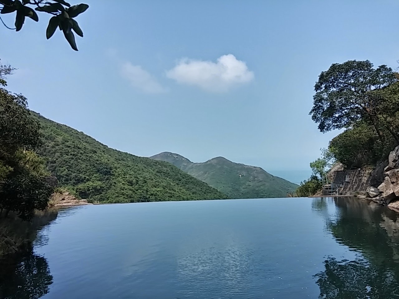
Man Cheung Po's infinity pool (萬丈布)

Duration: 
(4 kilometers)
1 hour

Difficulty: 3/10. 140m climb. Easy peasy...

Cel phone coverage: None.

Water needs: 0.5 liter

Appreciation: 9/10 for the infinity pool for a swim in the middle of summer

Transportation: Take bus 11 from Tung Chung to Tai O, and back. On weekends and holidays, there might be tons of people, then, you can take the ferry to Mui Wo, take bus 1 to Tai O and back.

Why it's worth it:

Garmin: http://connect.garmin.com/activity/481954409
---------------------------------------

If you go before 9am, head to Tung Chung, otherwise, ferry to Mui Wo and take bus #1 to Tai-O. You'll thank me for that...
Anyhow, for the early risers, when in Tung Chung, exit @ 'B'. Then go straight.

You should find bus stop 11 behind the bus terminus. About 45 minutes to Tai-O

Right behind the Tai-O bus terminus, there's a pier. Go there and just follow it around...

... to the little village and then to the right, along the shore for about 10 minutes

Follow the shore...

Follow the indications towards Man Cheung Po. Still following the shoreline at this point

Here, you still follow the Man Cheung Po sign, leaving the shoreline and climbing a bit

About 2.4 km into the hike (35 minutes), you'll reach this point...

... do NOT follow the Man Cheung Po signs at this point, just keep going on the path. Not the stairs, the path. You could take the stairs... but that would be wrong... So path it is, right?
(The concrete thing on the ground. Ok ok, just making sure, I'll just shut-up now)
(path...)

About another 8-10 minutes walk later, you'll reach a second set of stairs; those are good. Take them. They will lead you straight to the infinity pool.

Blue house. You're not lost

Pool in sight

There you are! Enjoy the waterfall and the infinity pool. Well, actually, it's a catch basin and you are technically not supposed to be or swim there... technically...

Pwetty...


Hike Hong Kong Web Site

HikeHongKOng on Facebook

Please, don't litter!

Hiking is about communion with nature. So please pickup after yourself. There's no excuse to leave plastic bags, water bottles or any rubbish on or around the trails; if you managed to bring it, you can manage to bring it back!