Monday, September 14, 2020

Sha Tin Wai to Choi Hung via Tate's Cairn, Elephant Hill (象山), and Kowloon Peak

Duration: 12.6 km (5h). 

Difficulty: 7/10. 689m elevation gain

Cel phone coverage: Everywhere

Water needs: 2 liters. 40% shaded. 

Appreciation: 9/10. 

Exercise Area: No

Transportation:  Sha Tin Wai MTR exit D. Return via Choi Hung MTR

Why it's worth it:


---------------------------------


At Sha Tin Wai MTR, exit via Exit 'D'...

Head left right out of exit 'D', and take the first right, which is going to be Shui Chuen Au Street

Soon enough, you'll see the tall, elevated pedestrian walkway on Shui Chuen Au street

Keep left at this intersection (about 10 minutes from Exit 'D')

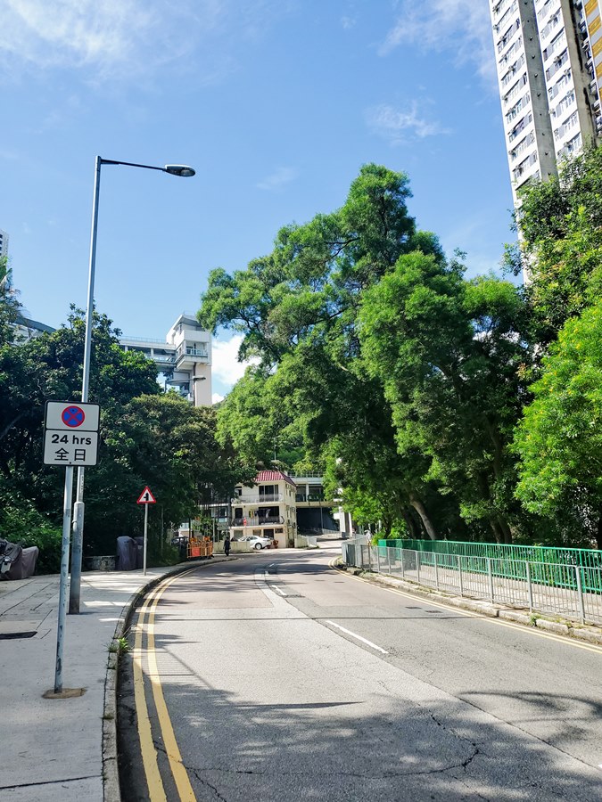
Then, just around the corner, head right and onto the road that goes by the large housing estates (on the left on the picture above)

This stretch of paved road is about 400m long.
You will hear the soothing burble of the stream on your right...

Then you will get on the trail proper

The stream will be audible on your right, all the way to the picnic site.

At one point, you'll reach a fork. Take a left and up the steps. The path going down on the right goes to the stream, should you decide to go a dip your toes...

About 40-50 minutes into your hike, you'll reach a bridge with this waterfall on your left, and you will then go through the picnic site.

Go straight...


About an hour in and 2.7km from Exit 'D', you will reach this point where the trail meets the paved road at Shatin Pass. Head left.

There's a little convenience store on the left in the distance.

Head left right after the convenience store (Shatin Pass road)


At about 4km from Exit 'D' and 1.5hour, you'll reach this fork with Kwun Ping road on the left.
Take a right, continuing on Shatin Pass road.

Another 500m and you will get to this fork where you will see a pavilion.
Head left onto Fei Gno Shan road.

The Tate's Cairn observatory will soon be in sight

Juse a couple hundred meters after, you will see the road to Tate's Cairn's observatory on the left. Take it.

Climb up the stairs

Enjoy the glorious views! Once you are done, retrace your steps to the main road and head left for another few hundred meters...

You will reach the Kowloon Peak viewpoint. There's another pavilion there. 

Go past the pavilion and head right to the path as shown in the picture above
(not the stairs up)

Left at the bushy fork


You will reach the Elephant Hill summit, there's just one path, you cannot get lost...

Kowloon peak in sight!

At this point, you will head left and all the way down Kowloon Peak. You will get through the cemetery just before you hit the road. At the road, head right. You will keep taking all the paths that are both going straight and down.


Choi Hung MTR is about 3.3km from the cemetery...

Sunday, September 6, 2020

Tei Shek stream (Tung Chung river West - 東涌河)

 Duration: 

3 km (2h). But you will most likely want to stay much longer to enjoy the natural pools.

Difficulty: 
7/10. Note that for some sections, you have to go in the water as there are no real bypasses. So, this is definitely a wet hike.

Cel phone coverage: Everywhere

Water needs: 1 liter. 50% shaded

Appreciation: 8/10. Nice and very clear stream. Lots of pools to soak in.

Exercise Area: No

Transportation: Exit 'B', go to the bus terminus, take 34 that brings you right at the trail-head (final stop). You can also take 34 right across from exit 'D' but if it gets busy, I always prefer to be at the terminus so I always have a spot. Return the same way. Check the bus' frequency as it is way-less frequent that typical HK buses. Just so you do not end up waiting an hour.  https://www.hkemobility.gov.hk/

Why it's worth it:
---------------------------------


Exit 'B', then...

... go straight through the building.

Straight

Bus 34's terminus is just in front of you. 

Take the bus and go all the way to the end stop.
It should take about 15 minutes

The bus/minibus end stop is right by the Shek Mun Kap Public Toilet (石門甲公廁).
Head left on the road that has a slight elevation


Just about a minute or two later, you will walk by the Tung Chung Lo Hon Monastery (東涌羅漢寺)


A few more minutes into the hike (about 550m from the bus stop), you will reach this fork. 
Take a right which will lead you right into the stream. Actually, it is the first time I see such a well maintained path just to get to a stream!

You arrive at the stream, head left...

... and a few meters after, you'll reach this water catchment. First time you'[ll have to wet your feet today, but not the last!


First pool. Clear water. Very nice!


About an hour into the hike. The tallest waterfall of that stream

Must be bypassed on the left, there are ropes and rock steps

Once you have reached the top of the first falls, keep left and use the ropes to pass the little bit of rock formations that do not offer enough of a ledge to climb on. Once passed, come down on the rope and cross the stream...

... as the bypass for the second falls is on the right. However, you can spend some time in the nice pool there before you keep on going, as this is the last major falls.


The exit point of the stream is about 25-40 minutes later. It is easy to miss if you do not pay attention as the path, while very close to the stream, is not visible from it. Pay attention to the shallow pool and rock characteristic rock face. The path is to the left, less than 5m away. 
Get out of the stream and head left on the path which will parallel the stream, all the way back to the same bus stop, closing the loop!


The bus stop in the distance. Note that you can always walk back to the MTR, which will take you about 45-50 minutes. Not an especially pleasant walk though...

Hike Hong Kong Web Site

HikeHongKOng on Facebook

Please, don't litter!

Hiking is about communion with nature. So please pickup after yourself. There's no excuse to leave plastic bags, water bottles or any rubbish on or around the trails; if you managed to bring it, you can manage to bring it back!