Appreciation: 4/10. Not very scenic. Lots of walking on paved roads. Not all that well signed. Not the most interesting hike. But still, if you live in Tseung Kwan O, can be good exercise.
Why it's worth it:
Duration:
5/10.
Cel phone coverage: Coverage everywhere.
Water needs: 0.5 liter.
Transportation: MTR to Lam Tin (Exit A). Return by Po Lam MTR.
Appreciation: 5/10. An easy hike that is short and shaded. There's quite a few streams so it would probably be better be done in the summer to get better water flow.
Why it's worth it:
Duration:
3.34k
226m elevation gain
Total: 1:15 hour
Garmin GPS route: http://connect.garmin.com/player/271244983
Difficulty:
4/10.
Cel phone coverage: Coverage everywhere.
Water needs: 0.5 liter.
(Updated: 2021-02-16)
Duration: 7km. Easy route: 3 hours. Scenic route: 3h45.
Difficulty:
Easy route: 5/10. 285m elevation gain.
Scenic route: 8/10. 348m elevation gain. But the high rating is based on the slippery path down High Junk Peak.
Cel phone coverage: 80% coverage.
Water needs: 1.5 liter. 60% shaded.
Appreciation: 8/10 for the easy route, 9/10 for the scenic route. Great views and an optional seafood dinner or lunch at the end in Po Toi O.
Scenic route: https://www.mapmyrun.com/workout/5481565603
Exercise Area: No
Transportation: If you are in Kowloon, take the MTR to Choi Hung, exit C2, then Take KMB bus 91 (stop is called Ngau Chi Wan Village but it is at the MTR station), get off at Ng Fai Tin stop. If you are on Hong Kong Island, take the MTR to Tseung Kwan O. Take green minibus 103/103M. It stops at the same place but you may have to let the driver know. There's just one return minibus, #16 in Po Toi O, which gets busy on weekends. It will bring you back to Tseung Kwan O, at the Hang Hau MTR station.
--------------------
 |
| Trail starts at the pavilion on Clear Water Bay road. The minibus/bus stop is just in front. There's a car park so it is quite easy to spot. |

|
| Cross the road to the pavilion. You can check the map out before you start your trek. |
 |
| At the beginning of the trail, there's a lot of other trails and bike trails crossing. Just keep going straight. You follow the signs for the pedestrian country trail to Tai Miu, not the bike trail |
|


 |
| Again, always follow the Country trail signs and you should not run into any problems. |
 |
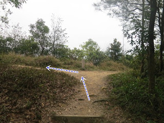
This is the critical spot in the hike. About 40-50 minutes into the hike and 1.7km from the start. If you head right. that is the the Easy way which bypasses Miu Tsai Tun and High Junk Peak. If you head left, passed the barrier, it is a bit more climbing, a bit more treacherous on the way down, but the views are much more impressive.
|
 |
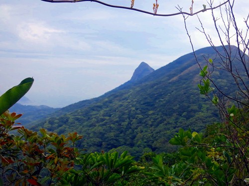
If you chose the Scenic path, you will get here, with a superb view of High Junk Peak ahead.
|
 |
| View from atop High Junk Peak |
 |
| After you descent from Hugh Junk Peak, you will reach this point with a trail map, where 4 paths meet. including the 'Easy' path. Whether you come from the Easy or Scenic path, just follow the path that is to the immediate left of the trail map. |
 |
| Clear water bay. Water is is amazingly clear |

|
| Po Toi O is in sight. Quite pretty. You can see the #16 green minibus stop by the village from this vantage point. You still have about 1km to go however. |
 |
| Almost there |
 |
| At the end of the country trail, head left on the road, then right at the first crossroad, towards Po Toi O. You are just 10 minutes away from the minibus bus stop |
 |
| Minibus #16 stop in Po Toi O. |
Please, don't litter!
Hiking is about communion with nature. So please pickup after yourself. There's no excuse to leave plastic bags, water bottles or any rubbish on or around the trails; if you managed to bring it, you can manage to bring it back!