8k, 3.5 hours
Difficulty:
8/10. 568m elevation gain. High difficulty on the way down as it is steep and slippery
Cel phone coverage: Everywhere.
Water needs: 1 liter.
Appreciation: 7/10. Nice views on a clear day
Why it's worth it:

-------------------------------
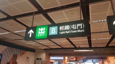 |
| Tuen Mun esxit 'B' |
 |
| Go West on Pui To Rd, over the Tuen Mun River |
 |
| Left on Tsing Wun Road |
 |
| Right on Hing Choi Street (Castle Peak will be visible right in front of you) |
 |
| Left on Yeung Tsing Road |
 |
| Right on Tsing Shan Monestary Path |


 |
| Take 10 minutes to visit the monastery which is one of the two most important in the area. |
 |
| Once done, climb up the stairs with the yellow railing |
 |
| Left at the first gazebo |
 |
| Right. There will be signs saying the hike is hard |

 |
| At the top, you'll find a gazebo. Head right and around the summit. From there, try to more or less follow the main path. Best to follow the GPS map because there are tons of little side-paths |


 |
| Left around the rock, then right |


 |
| Almost at the paved road |
 |
| Follow the paved road down |

 |
| Head right. Then right again at the main road... |
 |
| You will reach the light rail station. The one on your left will bring you back to the Tuen Mun MTR |

