Showing posts with label streams. Show all posts

Sunday, August 16, 2020

Gon Pak Stream (aka Gan Bai) (乾白石澗)


Duration: 
6.3 km (4 hours)

Difficulty: 
7/10. Elevation gain is 260m

Cel phone coverage: Very sparse

Water needs: 2 liters. 10% shaded

Appreciation: 9/10. Very nice waterfalls, lots of pools to cool-off in.


Exercise Area: No

Transportation: Green minibus #33 from Yuen Long MTR (exit B). Return via Siu Hong MTR.

Why it's worth it:

---------------------------------
Take the MTR all the way to Yuen Long. Exit 'B'. Then head right and walk along Long Yat Road. It will be a 5 minutes walk to Green Minibus #33.


You'll be turning right unto Shui Che Kwun Lane. You'll get to Shui Che Kwun road/Tung Tai Street. Keep right and straight on Tung Tai Street for about 50m.

You will see the minibuses lined up on your left, on Tai Fung street.
Green minibus #33 start from Tai Fung street
The minibus ride is about 25 minutes. It is not the final stop so you may want to show the driver the Chinese characters in the image above, which stands for 'Ha Pak Nai Public Toilet'.
That is where you need to get off.


The stream is the one right next to the road. You can just walk the 100 or so meters on the road until it veers to the right. At this point, enter the stream.


You can see the first waterfall in the distance...

The first waterfall, Silver Water Double Falls (銀水雙瀑).
About 1.3km into the stream, and 30 minutes to get there.
There's not much of a pool there to refresh yourself in. Waterfall bypass is on the left.

Next set of waterfalls. "Cascade on Stone Stage (石磐噴瀑)". Bypass is also on the left.


That one has a nice, shaded, mini-beach. Good place for a soak!

At this spot, the stream forks. Stay on the right.

Then again here, stay on the right.


Little gorge with a waterfall at the end (about 2.2km into the hike). "The Comb Waterfall Corridor (水梭瀑廊)". Can be bypassed on the right but it is much nicer to just walk in the water and the waterfall is an easy climb.

About another 100m in, the last waterfall. "The Slanting Slit Waterfall (斜縫瀑)"

The exit point is another few hundred meters (about 3.3km into the hike).
It will be on your left, and quite obvious.
You'll also see these 3 big round boulders on the right, at the exit point.

Path is obvious, no bushwhacking, but it is slippery.
You'll be climbing that path over a distance of about 300m.


Then you will reach the trail proper, with a view of various towns below.
Head right. You'll go by the popular Instagram spot that is Lam Tei (一線脊)

Just about 100m out, you will climb a hill with the characteristics rock formations on the picture above. This is where you will start your descent back to civilization (Siu Hong MTR station)...

... right here. It is slippery. Be careful.


Keep going down. There will be a stream on your left.
It was so hot I took a few minutes to soak-in and cool-down!
Then it is a forested path that will get you to a paved road...

... the paved road.


Once you get to Hong Po Road, you just have to follow-it for about 1km.


... until you reach this point.
Cross the road and go through the little forested area on the right in the photo above.

Almost at the MTR

Left of the basketball court. You will see escalators on your right that will 'elevate' you to the concrete platform you see on the picture above. Walk atop for about 100m to Siu Hong MTR station...


Sunday, June 25, 2017

HKU to The Peak via streams

Duration: 
2.5 hours, 6km
Difficulty:
6/10. Not very difficult but parts are overgrown and the thorny leaves and branches are really annoying


Cel phone coverage: Everywhere

Water needs: 1 liter

Appreciation: 7/10 after very large rainfall. I would think that it is very unimpressive when it hasn't rained

Transportation:
HKU Station Exit A1. Return via bus on The Peak

Details: http://www.mapmyrun.com/workout/2285580812/
Thanks to Iurgi for the original instructions that I used for my own visit: https://hkoutdooradventures.com/2017/04/06/to-the-peak-by-streams/

Why it's worth it:


--------------------------

Take the MTR to HKU. Exit A1, HKU FB level.

When out of the elevator, just go straight and cross the University grounds.

Behind the University, you'll see University Avenue. Take the stairs down to reach it, then head right.

Up the little hill...

The stairs to take will be on your left, right after the Chow Yei Ching Building.
Climb the stairs all the way to the top. Head right atop the stairs.

There will be many paths to your left. None to be taken. Keep going on the main path.

Similarly, many streams which may seem inviting... stay the course!

The first stream is about 1.4km from your starting point.

It is not too hard to find as there will be a flight of stairs on your right just before it.
Don't rely on the green boards being there. The stream actually has a well defined path following it.

Very pwehtty when there it has been raining a lot.

At one point, you'll reach a larger waterfall and the stream branches to the right as well, with the path following it. You will want to climb a few steps on the right, then take the path leading left to the top of the waterfall and to the left-stream.

From the entrance of the stream to the exit (pictured above), it should take you about 20-30 minutes. Head right. In about 800m (12-15min), you will connect with Hong Kong trail section 1

Keep going on HK trail section 1


Don't take stairs going down. HK trail section 1 I said!
About 3km and 1 hour walk from the exit of the first stream, you'll reach the entry point of the second stream. It might be easier to miss but one sure indicator that you missed it is if you get to the sharp turn in the trail

The second stream's entrance. One helpful indicator is the CW-28 sign on the left. Not sure whether that will stay there forever though...
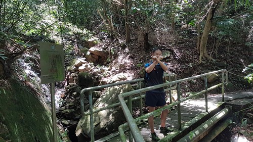
This second stream is about 700m long from entrance to exit. Try to stay in the stream as much as possible as the thorny bushes on the edge of the stream are, at best, annoying. Also, stick to the stream with most water, when encountering a fork. In all cases, it will more or less get to the same spot. But it will be easier and nicer in a larger stream

You'll eventually reach that bridge on Harlech Road. You'll get some mesmerized glances from people walking by. Go under the bridge  and climb the fence on the left. That's it! Head right on Harlech and you will be at The Peak in about 1 minute.

Hike Hong Kong Web Site

HikeHongKOng on Facebook

Please, don't litter!

Hiking is about communion with nature. So please pickup after yourself. There's no excuse to leave plastic bags, water bottles or any rubbish on or around the trails; if you managed to bring it, you can manage to bring it back!