Showing posts with label 1 hour. Show all posts

Saturday, August 29, 2020

Little Hawaii Falls dry hike (小夏威夷瀑布)

 Duration: 

4 km (1h15)

Difficulty: 
4/10. 

Cel phone coverage: Everywhere

Water needs: 1 liter. 90% shaded

Appreciation: 8/10. Nice and easy hike with nice waterfalls.

Exercise Area: No

Transportation: Exit 'C', Po Lam MTR station. Return via bus KMB 91 to Diamond Hill MTR station, Green minibus 1 to Choi Hung MTR. Actually, there are tons of buses and minibuses at 2 stops at the end point. https://www.hkemobility.gov.hk/

Why it's worth it:


-------------------------

At Po Lam MTR, use exit 'C' which is the one immediately in front of you once you have past the turnstiles.
Then immediately head right on Mau Yip Road

Mau Yip road

After 200m or so, you'll reach the end of Mau Yip road.
Cross the road and turn left onto Po Fung Road.


After another 200m, you will reach this point where you see a tunnel that goes under Po Hong Road. Don't take the tunnel, instead, head right on the path that parallels Po Hong Road.

After about 400m where you will have walk past the Po Tsui Park (on your right), you will reach this other tunnel which goes under Po Lam Road. Take it. You are about 5 minutes away from the beginning of the stream


As you get closer, you will see a waterfall in a distance (top encircled) as you enter the Tseung Kwan O village. You will also see a roundabout (bottom encircled)


About 1.8km into the hike, 25-30 minutes (from MTR exit 'C').
Head left to go see the Lin Yuen Terrace Falls


Lin Yuen Terrace Falls bridge

There's a waterfall on your left but you can't see it unless you go down on the rocks, on the left

And you will see these falls... quite nice

Upstream on the other side of the bridge, just hop on the rocks and about 20m out, you will see...

... these falls. Very very nice!

Once you are done, retrace your steps to the fork and the keep going on Little Hawaii trail (left)


At the next bridge, you can go downstream and on top of the waterfalls. Not has impressive as going up the falls but the only way to get that is to stream trek it.

Keep going. Not major waterfalls afterwards...


Clear Water Bay Road. Head left to the bus stops

Sunday, December 4, 2016

Rhino rock in Stanley (斜炮頂), Turtle rock, and St.Stephen beach

Duration: 
1 hour (2 km)

Difficulty: 7/10. Slippery slopes

Cel phone coverage: Everywhere

Water needs: 0.5 liter

Appreciation: 8/10. Nice views. A rock rhino head!

Transportation: Take bus 14 from Sai Wan Ho MTR station, Exit A (stop is right at the exit). Get off at the end stop, Stanley Fort. Return by either walking to Stanley and then taking whichever bus you want, or again, taking bus 14 back to Sai Wan Ho.


Why it's worth it:
---------------
The trail head is right by bus 14's final stop (Stanley Fort). These are military barracks.
Take the path up at the left of the gate

The path follows the fence

After about a 10 minutes climb, you'll have reached the top of the hill.
Take a right through the bushes

Left immediately into the bushes

The view will open up. Head to the right of the big round rock


You can see the path at this point, just follow. I circled your destination*


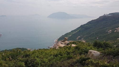
You'll reach this point where there's a fork. On your left, you can see the 'turtle rock' from where the peeps on the picture are. It is displayed on the second photo from my title picture at the top of this blog entry. You have to have a bit of imagination. This is not the rhino rock. To go to the rhino rock, head right...

This is the rhino rock from behind

There ya go! This one, no imagination required; quite a good rendition.
With the Stanley prison in the background. When you are done taking half a million pictures, retrace your steps all the way back to the top of the hill where you found the marker...

Here... So, you can always retrace your steps back to the end-stop of bus 14. But instead, I suggest, you go around the little building to discover some more cool stuff...

A little gem of a bamboo jungle!

Left, behind the big rock


You'll see a water pipe, just follow it on the right. It will lead you to the road. Head right on the road until you reach the bus stop to return to Sai Wan Ho. Alternately, you can go down to the beach!

St,Stephen's beach. Quite pretty

Monday, October 31, 2016

Grass Island (Tap Mun - 塔門)

Duration: 
1 hour (1 km)

Difficulty: 1/10

Cel phone coverage: Everywhere

Water needs: 1 liter

Appreciation: 7/10. While it is very far and not easily accessible, Tap Mun is quite pretty and populated with friendly feral cows. Nice local food to have on the island as well. Snacks from the aunties (no uncles in sight for some reason)

Transportation: Ferry from the Ma Liu Shui @ University MTR station, or from the Wong Shek pier in Sai Kung. About 1h15 ferry

Why it's worth it:


-----------------------
The island is so small that I won't bother with trails there; there's one that circles the part of the island open for visit. Instead, I'll show you how to get to the island itself.

First way:
On weekends and public holidays, the bus 96R will take you from Diamond Hill MTR to Wong Shek Pier. Then take the ferry to Tap Mun from there

Second Way:
Take the ferry from University MTR station

University MTR exit A. Exit and go left
Stop by the sign right at the exit on the left

Here's how to get to the pier. About 10 minutes walk


Around and over the highway

Over the highway again, down the stairs on the left, then through. Then go through the parking lot. Once you are through all the roads, head left


Hike Hong Kong Web Site

HikeHongKOng on Facebook

Please, don't litter!

Hiking is about communion with nature. So please pickup after yourself. There's no excuse to leave plastic bags, water bottles or any rubbish on or around the trails; if you managed to bring it, you can manage to bring it back!