Duration:
(8 kilometers)
4h20
Difficulty: 6/10 363m max elevation.
Cel phone coverage: 100%
Water needs: 1.5 liter
Transportation: Get to Tai O via bus 11 from Tung Chung
Why it's worth it:
Exercise Area: No
---------------------------------------------
 |
| Right off the bus, walk back on Tai O road in the direction the bus came from. |
 |
| After 12-15 minutes into the hike and 700m, you will reach that bridge. Turn right into the road just before it. |
 |
| At the next fork, take a right instead of following the path along the river |
 |
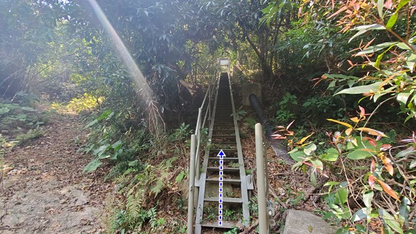
| The path will go up after another 100m and you will take the metal stairs on your right. All the way up! |
 |
| Head left at the top of the metal stairs. |
 |
| You will go around on the left of the fenced buildings, then, immediately after, there's a path going down and one on the right. Take the one on the right. |
 |
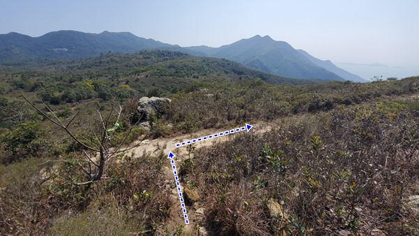
| About an hour into the hike and having climbed the first little hill, you will reach this point where the trail goes to the left, and to the right. The left goes to the relic of a statue. Head right. |
 |
| You should reach the Lantau trail 15 minutes later. Head left but the continuation of your trail is then immediately to you right. It is marked by a yellow ribbon around a tree. |
 |
| You just have to follow the trail afterwards for about 1.7km, you will then be going down and... |
 |
| ...reach this point which is where you reconnect to the Lantau trail. Head right. |
 |
| Another 1.75km or so, after downhill zig-zags, you will reach the shore and the trail to Tai O. Head right. |
 |
| As you arrive at the little village before Tai O (Fan Kwai Tong), you will see the pedestrian bridge (above pic). Take it and it will get you back to your starting spot. |


