Duration: 5.5 km (4h).
Difficulty: 7/10. 243m elevation gain. Lots of big boulders. Do NOT go when the forecast calls for rain as it is likely that this stream gets serious flash floods.
Cel phone coverage: Everywhere
Water needs: 1.5 liters. 95% shaded.
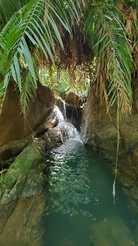
Appreciation: 9/10. While the stream is a bit dirty, there are lots of waterfalls in the mid-part.
Map & Details: https://www.mapmyrun.com/workout/4669460785/
Exercise Area: No
Transportation: Sha Tin Wai MTR exit D (loop)
Why it's worth it:
Oh, I also saw these guys!
 |
| Chinese water dragon |
-------------------------------
 |
| At Sha Tin Wai MTR, exit via Exit 'D'... |
 |
| Head left right out of exit 'D', and take the first right, which is going to be Shui Chuen Au Street |
 |
| Soon enough, you'll see the tall, elevated pedestrian walkway on Shui Chuen Au street |
 |
| The entrance to the lower part of the stream. That section does not have a lot of waterfalls |
 |
| The road or path is never more than 5-10 metres out on your left. So, you can exit the stream at any point if you are done, or if it starts raining... |
 |
| This is the end of the lower section of the stream. Beyond that point is the middle section |
 |
| That's the end of the middle section. Spot the tree and the waterfall on the left. That is the only fork in the stream. Exit on the left. |
 |
You will arrive right by this picnic/BBQ area |
 |
| Retrace your steps but on the trail this time, all the way back down to Sha Tin Wai... |


