Appreciation: 8/10. Scenic. An easy, short hike that's quite easy to access.
Why it's worth it:
6.15k
345m elevation gain
Total: 2 hours 10 min
Garmin GPS route: http://connect.garmin.com/activity/276499006
Difficulty:
345m elevation gain
Total: 2 hours 10 min
Garmin GPS route: http://connect.garmin.com/activity/276499006
Difficulty:
4/10.
Cel phone coverage: Coverage everywhere.
Water needs: 1 liter.
Transportation: MTR Tsing Yi (Exit A2. Go through the mall. Go one level down). Tons of buses and 2 mini-buses will return you to Tsing Yi close to the end of the trail.
--------------------
 |
| Refer to the numbered photos for reference to this map |
 |
| Exit A2 at Tsing Yi MTR. That's leads you into the mall. Go through and go down one level. The mall exits right to the promenade. Head left. |
 |
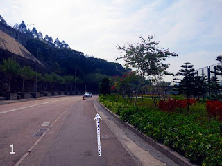
| Right after the Tsing Yi Northeast park. Just follow the Tam Kon Shan road for a little while. |
 |
| Be on the lookout after the public toilet on the right for the sign for Tsing Yi Nature trail that will be on the left. Head left. |
 |
| The sign. There will be a bunch of steps. Not that many really. |
 |
| The the tunnel that gets you under the highway. |
 |
| Then right after, the paths split. Take the stairs. |
 |
| About 10 minutes walk or so later, you'll reach the minibus bus terminal. Take the stairs on the right and head right on Lio To road. The road will curve to the left after about 200 meters. |
 |
| End of pavement and Lio To. From that point on, it's all trails. |
 |
| Head right. |
 |
| Head right. |
 |
| The path is new and quite nice. You'll go past a few gazebos and swings. |
 |
| At this point, if you head left, that's the short way back to the North Entrance of the trail, where you came from. You want to head right towards the South Entrance. |
 |
| Nice views of the bridge. Supposed to be really nice at sunset. |
 |
| End of the trail proper. If you head left and walk and extra 150 meters, you'll reach the bus stop. Various buses will take you back to Tsing Yi. The two minibuses are probably your best option. |


