(Updated 2018-APR-02)
Duration: 8k, 3 hours
Duration: 8k, 3 hours
Difficulty:
6/10. Downhill pretty much all the way. However, there are zillions of steps and it will be a good workout. I'd say it's not for people that are totally unfit.
6/10. Downhill pretty much all the way. However, there are zillions of steps and it will be a good workout. I'd say it's not for people that are totally unfit.
Cel phone coverage: Full
Water needs: 0.75 liter
Appreciation: 8/10. Nice views on a clear day. Big Budha. Monastery.
Map & Details: http://www.mapmyhike.com/workout/2795062298
Exercise Area: No
Transportion: Bus 23 from Tung Chung MTR, or cable car. Return via Tung Chung MTR.
Relive.cc:
Why it's worth it:
--------------------------------
 |
When you arrive at Tung Chung via MTR, get out at Exit B. Go around the left of the building facing you.
Bus 23 is in the back of the building. There should be quite a few people taking it.
For bus schedule details, go to the extremely useful government PTES web site: http://ptes.td.gov.hk/index.php?golang=EN
|
 |
| After a 35 or so minutes bus ride, you will arrive at Ngong Ping. Take some time to visit the Budha, the monastery and everything else you feel like. Quite touristy. Once you are ready to hike down. You will need to get through the "village" and towards the cable car station. |
 |
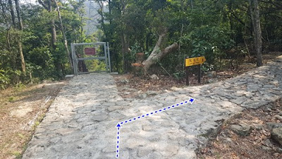
| The trail head. It's paved most of the trail |
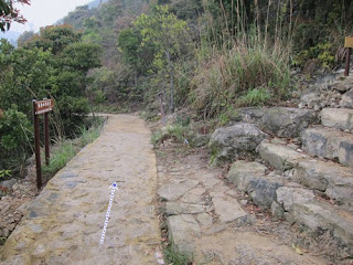
About 7-8 minutes in, there will be a path going up. Don't take it, keep going straight.
When in view of pylon #6, climb towards it. Don't take the path on the right.
Steps can be very steep. Be careful.
 |
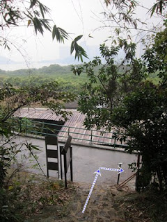
| End of the trail, head right |
 |
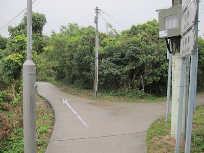
| Head left here |
 |
| Head right at the next fork, then up the stairs |
 |
| Head left after the stairs |
 |
| Don't take the first pedestrian overpass, just walk along on the left |
 |
| Velly pletty! |
 |
| Do take the second footbridge. It goes over the road. |
 |
Eventually, you'll reach the pedestrian tunnel. Go down, then right (follow the big arrow!).
Then left as you exit the tunnel. You'll sign signs for the MTR
|


