Duration:
(15 kilometers)
5.5 hours; 2 hours from Tung Chung to Sham Wat village, 45 minutes Sham Wat to stream. 2.5 hours in stream. 15 minutes from stream to Ngong Ping.
Difficulty: 9/10. The stream is more difficult than Wong Lung Hang because of the large boulders and sometimes tricky passes. But WLH gets higher rating because of the rope part at the end. In any case, not a stream for people with no stream-trekking experience
Cel phone coverage: Not in stream
Water needs: 2 liters
Appreciation: 9/10
Transportation: Start at Tung Chung MTR, Exit A. Return via bus 23 at Ngong Ping, to Tung Chung. Last bus at 19:10!
Why it's worth it:
---------------------------------------
 |
| First half, the flat hike to Sham Wat village |
 |
| Tung Chung MTR Exit A. |
 |
| Cross all the cab stops towards the apartment towers in front of Exit A. |
 |
Refer to Point 1 on the map. You will be on a path that parallels Tai Tung Road until it reaches Shun Tung Road.
Do not turn right into the tunnel, instead, turn left. |
 |
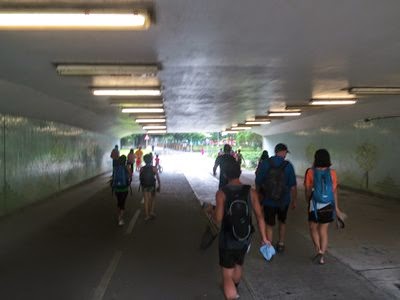
| After about 100 meters, there will be a tunnel on your right. Take it. |
 |
Bunch of steps right in front of you. Don't take them, follow the path on the left.
|
 |
| After the tunnel, walk about 200 meters and take the catwalk over Chung Yan Road. |
 |
| Keep walking for another 200 meters or so, you'll go past housing estates on your right and get to another catwalk. Don't take that one, just keep going straight. |
 |
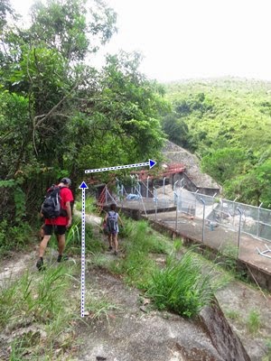
| Just before the end of Tu Yung Road, you will turn right at a sign post indicating the way to Hau Wong temple. |
 |
| Down the stairs, turn left. |
 |
| In general, just follow the signs indicating Tai O. |
 |
| About 1 kilometer in, in a small village. |
 |
| Just added this one because it may be confusing. But again, just follow the signs that indicate Tai O. From this point on, in it smooth walking without real possibilities of a wrong turn until Sham Wat Wan, 9 kilometers along the way. |
 |
Sham Wat Wan. The ladies there at the village will surely remind you that there's food to be had if you are hungry. If you don't plan to stop, keep walking on the road through the village and over the bridge.
|
 |
After the bridge, just keep going straight on the road. You are starting your paved climb towards the stream entrance
|
 |
Make your way up to point #2, at about 105m altitude...
|
 |
| ...don't miss that turn on the left. The sign reads 'Sham Wat Catchwater (East)'. |
 |
| A few hundred meters in, you'll see a catch-water basin on the right but keep going, that's not the entry point |
 |
| At the next bridge is the actual entry point of the stream. Go down the stairs (past the sign with a skull that warns you of your impending death), go to the rightmost stream. The boulders are quite large, which might make them a bit challenging |
 |
| Nei Ngong waterfall (彌昂飛瀑). Bypass on the left. If at any point, the climb looks too difficult, chances are that there's a ribbon delimited bypass. |
 |
| Here's the most important split to remember. On the right, the Ngong Sham stream, much more difficulty. Stay on the left on the Nei Sham stream which is easier |
 |
| Almost there. You will be right under the Ngong Ping cable line |
 |
| The spot where we exited the stream. I put some blue ribbons on the right to indicate the path. The path itself is quite well-used so if it is not too late in the evening, you should find it easily. Remember, it's on the right. |
 |
| At the top of the exit path, you'll reach the Lantau trail, make a right and you'll reach Ngong Ping in about 10-15 minutes. From there, you can take a bus back to Tung Chung (MTR), or Tai-O or Mui-Wo |


